.svg "edstellar")
.webp)
Spatio-Temporal Data Science for Supply Chain Optimization Corporate Training Program
This training covers spatio-temporal data science techniques for supply chain optimization, including geospatial modeling, demand forecasting, route optimization, and real-time logistics analytics.
(Virtual / On-site / Off-site)
Drive Team Excellence with Spatio-Temporal Data Science for Supply Chain Optimization Corporate Training
Spatio-temporal data science combines geographic information analysis with time-series modeling to solve complex supply chain challenges. Organizations use these techniques to optimize logistics networks, forecast spatially distributed demand, minimize routing costs, and monitor real-time operations across global distribution channels. This training covers the full analytical workflow from spatial data collection and integration through predictive modeling, route optimization, and network resilience analysis.
Edstellar's Spatio-Temporal Data Science for Supply Chain Optimization Instructor-led course offers virtual/onsite training options so teams can learn in the format that best fits their operations. The curriculum blends geospatial modeling theory with hands-on Python and R workshops, enabling participants to apply spatio-temporal analytics directly to their organization's supply chain challenges and achieve measurable improvements in logistics efficiency.
.svg)

Skills Your Employees Will Gain
These are the core, hands-on capabilities your team builds during the program.
- Spatio-Temporal Data Analysis
- Geospatial Modeling
- Demand Forecasting
- Route Optimization
- Supply Chain Network Analysis
- Real-Time Logistics Analytics
- Spatial Data Visualization
What Your Team Will Achieve After This Training
- Master spatio-temporal data analysis techniques to model and optimize supply chain operations and logistics networks.
- Gain hands-on skills to build geospatial models and location-based demand forecasting systems for supply chain planning.
- Develop route optimization workflows using spatial algorithms and network analysis to reduce logistics costs and delivery times.
- Learn to process and analyze real-time spatio-temporal data streams for dynamic supply chain decision-making.
- Build proficiency in spatial data visualization tools to communicate supply chain insights to operational stakeholders.
- Apply end-to-end spatio-temporal data science pipelines to achieve measurable supply chain optimization outcomes.
Topics & Program Outline
The curriculum is organized into focused modules built by industry experts and delivered virtually or on-premise. Interactive sessions reflect the evolving demands of the workplace, keeping the learning both relevant and practical.
-
Introduction to Spatio-Temporal Concepts
- Definition of spatio-temporal data and its role in data science applications
- Key dimensions of spatial and temporal data and how they interact in analysis
- Applications of spatio-temporal data science across logistics, operations, and planning
- Overview of the supply chain optimization problem landscape and data requirements
-
Geographic Information Science Fundamentals
- Core concepts of geographic information science and spatial data models
- Raster vs vector data structures and their use cases in supply chain analysis
- Coordinate reference systems, projections, and their impact on spatial calculations
- Topology and spatial relationships between geographic features and supply nodes
-
Time-Series Analysis Fundamentals
- Time-series data structures and indexing for temporal supply chain datasets
- Trend, seasonality, and cyclical components in supply chain time-series data
- Autocorrelation and stationarity tests for temporal data preprocessing
- Combining temporal decomposition with spatial attributes for enriched analysis
-
Python and R for Spatio-Temporal Analysis
- Key Python libraries: GeoPandas, Shapely, Fiona, and PySAL for spatial analysis
- R spatial packages: sf, sp, raster, and spatstat for geospatial computation
- Setting up a spatio-temporal analysis environment with Jupyter and RStudio
- Working with spatial data frames and performing basic geospatial operations
-
Spatio-Temporal Data Formats and Standards
- Shapefile, GeoJSON, GeoPackage, and KML formats for spatial data storage
- NetCDF and HDF5 formats for gridded spatio-temporal scientific datasets
- Open data standards in geospatial: OGC, WMS, WFS, and INSPIRE specifications
- Converting between spatial formats and integrating with supply chain data pipelines
-
Overview of Supply Chain Optimization Problems
- Core supply chain optimization problem categories: location, routing, and scheduling
- How spatial and temporal constraints shape supply chain optimization challenges
- Trade-offs between cost, speed, and resilience in supply chain network design
- Mapping supply chain business problems to appropriate spatio-temporal analytical methods
-
Supply Chain Spatial Data Sources
- GPS and telematics data from fleet vehicles, warehouses, and delivery assets
- Government and open data portals for road networks, administrative boundaries, and infrastructure
- Satellite imagery and remote sensing data for facility monitoring and land use
- Commercial spatial data providers for points of interest, trade areas, and demographics
-
IoT and Sensor Data Integration
- IoT device architecture for collecting real-time location and condition data
- RFID and barcode scanning integration for tracking goods through the supply chain
- Handling IoT data streams: ingestion, buffering, and preprocessing for spatial use
- Data quality challenges in IoT sensor feeds and strategies for cleaning location data
-
Spatial Database Systems
- PostGIS for storing and querying spatial data in PostgreSQL databases
- Spatial indexing methods: R-trees, quad-trees, and grid-based index structures
- Writing spatial SQL queries for proximity, containment, and overlay operations
- Scalable spatial databases for high-volume supply chain location data workloads
-
ETL Pipelines for Spatial Data
- Designing extract, transform, load pipelines for heterogeneous geospatial data sources
- Handling coordinate system transformations and datum conversions in ETL workflows
- Data integration patterns for merging spatial data with ERP and WMS systems
- Automating spatial data refresh cycles for near-real-time supply chain analytics
-
Data Quality and Preprocessing
- Common spatial data quality issues: invalid geometries, topology errors, and missing coordinates
- Geocoding and reverse geocoding addresses to geographic coordinates for supply chain data
- Map matching GPS traces to road network segments for accurate route analysis
- Outlier detection and noise reduction techniques for GPS and sensor location data
-
Supply Chain Data Enrichment
- Joining supply chain records to spatial boundaries for regional performance analysis
- Adding demographic, infrastructure, and weather data to supply chain spatial datasets
- Creating spatial features from raw supply chain transaction and movement data
- Building a unified supply chain spatial data warehouse for analytical workloads
-
Graph Theory Fundamentals for Supply Chains
- Nodes, edges, and network properties relevant to supply chain topology
- Directed vs undirected graphs and weighted edges in supply chain modeling
- Representing supply chain networks as spatial graphs with geographic attributes
- NetworkX and igraph for supply chain network construction and analysis in Python
-
Network Topology and Flow Analysis
- Centrality measures: degree, betweenness, and closeness centrality in supply networks
- Flow capacity analysis and bottleneck identification in distribution networks
- Shortest path algorithms: Dijkstra and A-star for supply chain routing decisions
- Maximum flow and minimum cut analysis for supply chain capacity planning
-
Hub and Spoke Network Analysis
- Hub location problem formulation for distribution center placement optimization
- Spatial analysis of hub catchment areas and service zone boundaries
- Multi-hub network design and inter-hub connection optimization techniques
- Trade-off analysis between hub consolidation efficiency and last-mile delivery cost
-
Network Resilience and Vulnerability
- Identifying single points of failure and critical nodes in supply chain networks
- Simulating disruption scenarios and measuring network recovery capacity
- Spatial risk mapping of supply chain vulnerability to geographic hazards
- Building redundancy into supply chain network design for operational continuity
-
Multi-Echelon Network Optimization
- Multi-tier supply chain structures: suppliers, manufacturers, distributors, and retailers
- Modeling inventory and transportation trade-offs across multiple network echelons
- Spatial allocation of inventory across echelons to minimize total network cost
- Integer programming formulations for multi-echelon supply chain network problems
-
Network Benchmarking and Comparison
- Defining network performance KPIs for supply chain efficiency benchmarking
- Comparing current network structure against optimized alternative configurations
- Using geospatial analytics to identify underserved areas and coverage gaps
- Visualizing supply chain network performance on interactive geographic maps
-
Spatial Patterns in Demand Data
- Understanding geographic variation in customer demand and its supply chain implications
- Spatial autocorrelation analysis to detect clustering and dispersion in demand data
- Moran's I and LISA statistics for identifying demand hotspots and cold zones
- Visualizing spatial demand patterns to guide inventory positioning decisions
-
Geographically Weighted Regression
- Limitations of global regression models for spatially heterogeneous demand data
- Geographically weighted regression principles and bandwidth selection methods
- Interpreting local regression coefficients and spatial variation in driver effects
- Applying GWR results to spatially differentiated demand planning strategies
-
Time-Series Forecasting for Demand
- ARIMA and SARIMA models for univariate demand forecasting with seasonal patterns
- Exponential smoothing methods for short-horizon supply chain demand forecasts
- Prophet and neural forecasting models for trend and seasonality estimation
- Evaluating forecast accuracy with MAE, RMSE, and MAPE across geographic regions
-
Machine Learning for Spatial Demand Forecasting
- Feature engineering for spatial demand models: location features and proximity indices
- Gradient boosting and random forest models for multi-variate demand prediction
- Cross-validation strategies that respect spatial and temporal data dependencies
- Ensemble forecasting combining statistical and machine learning spatial models
-
Demand Sensing and Real-Time Signals
- Using point-of-sale, social media, and mobility data as demand leading indicators
- Integrating weather and event data into spatial demand forecasting pipelines
- Short-term demand sensing models for dynamic replenishment in distribution networks
- Updating spatial demand forecasts in near-real-time as new signal data arrives
-
Forecast Deployment and Inventory Integration
- Translating spatial demand forecasts into regional inventory positioning decisions
- Integrating spatial forecasts with S&OP and demand planning processes
- Forecast error propagation across supply chain echelons and its spatial implications
- Building automated spatial demand forecast pipelines for recurring operational use
-
Vehicle Routing Problem Fundamentals
- Formulating the Vehicle Routing Problem and its key variants for logistics
- Constraints in VRP: time windows, vehicle capacity, and driver working hours
- Exact vs heuristic solution methods for practical-scale routing problems
- Open-source routing tools: OR-Tools, OSRM, and Vroom for supply chain routing
-
Traveling Salesman Problem and Extensions
- TSP formulation and its relevance to single-vehicle last-mile delivery problems
- Nearest neighbor, 2-opt, and Lin-Kernighan heuristics for TSP optimization
- Multi-depot and open route extensions of the TSP for complex logistics networks
- Benchmark performance comparison of TSP algorithms on real delivery datasets
-
Facility Location Optimization
- P-median and P-center problems for optimal warehouse and depot placement
- Coverage models for ensuring service reach within time and distance thresholds
- Gravity models and market potential analysis for distribution center location
- Sensitivity analysis for facility location decisions under demand uncertainty
-
Last-Mile Delivery Optimization
- Challenges of last-mile delivery and its disproportionate contribution to total cost
- Crowdsourcing and micro-depot strategies for last-mile urban delivery efficiency
- Parcel locker and pickup point placement using spatial access and demand data
- Dynamic route adjustment for failed deliveries and time-window management
-
Multi-Objective Route Optimization
- Balancing cost, time, emissions, and service quality in multi-objective routing
- Pareto front analysis for identifying optimal trade-off solutions in routing
- Green logistics: minimizing carbon emissions in route optimization problems
- Incorporating real-time traffic and road condition data into routing models
-
Dynamic and Re-Optimization Strategies
- Dynamic VRP and adaptive routing for changing delivery conditions in real time
- Event triggers for route re-optimization: cancellations, additions, and delays
- Online vs offline routing algorithms and their suitability for different operations
- Measuring route optimization ROI through distance, time, and cost reduction metrics
-
Streaming Data Architectures
- Event-driven architectures for real-time spatio-temporal supply chain data processing
- Apache Kafka for high-throughput location data ingestion and stream management
- Apache Flink and Spark Streaming for real-time spatial data processing at scale
- Latency requirements and SLA considerations for real-time supply chain analytics
-
Real-Time Vehicle and Asset Tracking
- GPS fleet tracking systems and data integration with supply chain platforms
- Geofencing for automated alerts when assets enter or exit defined geographic zones
- Real-time estimated time of arrival calculation using traffic-aware routing engines
- Asset utilization monitoring through real-time location and movement analytics
-
Event-Driven Supply Chain Monitoring
- Defining supply chain events: delays, deviations, temperature excursions, and exceptions
- Complex event processing for detecting multi-step supply chain disruption patterns
- Real-time alerting and escalation workflows for supply chain exception management
- Building supply chain control tower dashboards with real-time event feeds
-
Anomaly Detection in Logistics Streams
- Statistical methods for detecting anomalies in real-time location and sensor data
- Machine learning anomaly detection for unusual route deviations and delays
- Threshold-based and model-based anomaly detection trade-offs for logistics data
- Reducing false positives in supply chain anomaly detection through contextual rules
-
Real-Time Dashboard Design
- Designing operational dashboards for logistics managers and control room teams
- Selecting real-time map visualization tools for supply chain operational monitoring
- Key real-time KPIs: on-time delivery rate, fleet utilization, and dwell time metrics
- Balancing dashboard refresh frequency with data latency and system performance
-
Latency, Throughput, and Scalability
- Understanding latency constraints in real-time supply chain location data pipelines
- Horizontal scaling strategies for high-volume GPS and IoT data stream processing
- Edge computing for pre-processing location data closer to the source assets
- Cost and performance trade-offs in cloud vs edge real-time analytics architectures
-
Spatial Interpolation Methods
- Inverse distance weighting for estimating values between known supply chain locations
- Kriging methods for geostatistical interpolation of spatial supply chain variables
- Triangulated irregular networks for surface modeling in logistics terrain analysis
- Selecting the appropriate interpolation method based on data distribution characteristics
-
Hotspot and Cluster Analysis
- Kernel density estimation for identifying demand concentration and delivery hotspots
- Getis-Ord Gi* statistic for spatial hotspot detection in supply chain datasets
- DBSCAN and hierarchical clustering for spatial segmentation of delivery zones
- Using hotspot maps to prioritize warehouse stocking and delivery capacity allocation
-
Catchment Area and Territory Analysis
- Drive-time and drive-distance isochrones for defining warehouse service catchments
- Territory design for sales, service, and distribution using spatial optimization
- Balancing territory workload, coverage, and geographic compactness simultaneously
- Reassigning territories dynamically as demand patterns and capacity constraints change
-
Distance Decay and Accessibility Models
- Distance decay functions and their role in modeling supply chain accessibility
- Network-based accessibility analysis using road and transit network impedance
- Gravity models for estimating trade flows between supply chain origin-destination pairs
- Applying accessibility modeling to facility siting and delivery zone optimization
-
Spatial Regression and Modeling
- Spatial lag and spatial error regression models for supply chain performance factors
- Testing and correcting for spatial autocorrelation in regression residuals
- Spatial panel data models for multi-period supply chain performance analysis
- Validating spatial regression models with out-of-sample geographic data splits
-
Heatmaps and Density Analysis
- Creating supply chain heatmaps from order, delivery, and incident data
- Temporal animation of supply chain heatmaps to reveal time-based spatial patterns
- Aggregating point data to hexagonal grids and census boundaries for reporting
- Using density maps to inform network redesign and capacity expansion decisions
-
Supply Chain Risk Identification
- Categories of supply chain risk: supplier, logistics, demand, and environmental
- Mapping supply chain risk exposure geographically to identify concentration areas
- Data sources for supply chain risk assessment: news, weather, geopolitical, and financial
- Building a risk register with spatial attributes for each identified risk category
-
Climate and Environmental Risk Modeling
- Sourcing climate and weather data for supply chain disruption risk analysis
- Flood, storm, and wildfire risk mapping for supply chain facility and route exposure
- Long-term climate trend analysis and its impact on supply chain network resilience
- Integrating climate risk scores into facility location and network design decisions
-
Supplier Geographic Risk Assessment
- Mapping supplier concentration risk by geography, country, and trade corridor
- Political instability and trade restriction risk scoring for supplier locations
- Transportation corridor risk analysis for critical supply chain routes and chokepoints
- Diversification strategies for reducing geographic supplier concentration risk
-
Predictive Disruption Modeling
- Machine learning models for predicting supply chain disruptions from historical data
- Leading indicator identification for early warning supply chain risk detection
- Simulation-based disruption modeling using Monte Carlo and agent-based methods
- Quantifying disruption impact in financial and operational supply chain terms
-
Scenario Analysis and Contingency Planning
- Defining disruption scenarios by severity, geographic scope, and duration
- Spatial scenario modeling for evaluating alternative supply chain network configurations
- What-if analysis for testing supply chain responses to simulated disruption events
- Documenting contingency plans with geographic action triggers and response protocols
-
Risk Visualization and Communication
- Creating supply chain risk maps that convey probability and impact clearly
- Risk heat maps overlaid on supply chain network maps for executive reporting
- Interactive risk dashboards for ongoing monitoring of geographic supply chain exposure
- Communicating spatial risk findings to supply chain leadership and board stakeholders
-
Web-Based Mapping Technologies
- Leaflet.js for building interactive web maps for supply chain stakeholder dashboards
- Mapbox GL for high-performance vector tile mapping and custom supply chain layers
- Deck.gl for visualizing large-scale spatio-temporal supply chain movement data
- Embedding web maps in supply chain operational dashboards and reporting portals
-
Supply Chain Dashboard Design
- Principles of effective dashboard design for supply chain operations and management
- Selecting the right chart types and map layers for each supply chain KPI
- Combining spatial maps with time-series charts in integrated supply chain views
- Designing for different audiences: operational, tactical, and strategic reporting
-
Interactive Geospatial Visualization
- Plotly and Folium for creating interactive geographic plots in Python notebooks
- Kepler.gl for exploratory spatio-temporal analysis and large dataset mapping
- Filtering and drill-down interactions for supply chain map exploration
- Animation and playback of temporal supply chain data on interactive maps
-
BI Tools for Geospatial Reporting
- Power BI geospatial visuals and Bing Maps integration for supply chain reporting
- Tableau geographic maps and spatial joins for supply chain performance analysis
- Looker and Google Data Studio map layers for supply chain geographic dashboards
- Publishing and sharing geospatial supply chain reports with business stakeholders
-
Storytelling with Supply Chain Maps
- Narrative mapping techniques for guiding stakeholders through spatial findings
- Before-and-after map comparisons to demonstrate optimization and improvement impact
- Annotation and callout techniques for highlighting key geographic supply chain insights
- Presenting spatial analysis results in executive briefings and board-level reports
-
Automated Reporting and Data Pipelines
- Scheduling automated geospatial supply chain reports for daily and weekly delivery
- Building parameterized report templates that update with refreshed spatial data
- Integrating Python-based map outputs into PDF and PowerPoint reporting workflows
- Monitoring data freshness and pipeline health for production spatial reporting systems
-
End-to-End Pipeline Design
- Scoping and defining a supply chain spatio-temporal optimization project from scratch
- Selecting appropriate data sources, models, and tools for the optimization objective
- Building a reproducible analysis pipeline with version control and documentation
- Validating pipeline outputs against real supply chain performance benchmarks
-
Integration with Supply Chain Systems
- Connecting spatio-temporal analysis outputs to ERP and WMS platforms
- API design for exposing spatial optimization results to operational decision systems
- Change management for embedding data-driven spatial decisions in supply chain processes
- Measuring adoption and business impact of deployed spatial optimization solutions
-
Performance Benchmarking
- Defining supply chain optimization KPIs: cost per unit, delivery time, and service level
- Before-and-after benchmarking methodology for supply chain improvement projects
- Statistical significance testing for measured supply chain performance improvements
- Presenting benchmarking results to supply chain leadership and finance teams
-
Industry Case Studies
- Retail supply chain optimization using spatial demand forecasting and network redesign
- E-commerce last-mile optimization with dynamic routing and geofenced delivery zones
- FMCG distribution network rationalization using multi-echelon spatial modeling
- Pharmaceutical cold chain monitoring using real-time spatio-temporal IoT data
-
Continuous Improvement Frameworks
- PDCA and DMAIC frameworks applied to spatio-temporal supply chain analytics
- Building model retraining pipelines for spatial supply chain models over time
- Feedback loops between operational teams and analytics for continuous model improvement
- Scaling successful spatial optimization pilots across the broader supply chain network
-
Future Trends in Spatio-Temporal Supply Chain Analytics
- Autonomous vehicle and drone delivery integration with spatio-temporal optimization
- Digital twin technology for real-time supply chain simulation and scenario planning
- AI-driven supply chain orchestration combining spatial, temporal, and demand signals
- Quantum computing potential for solving large-scale supply chain routing problems
Who Should Attend?
This program suits professionals at many levels across the organization, including:
- Supply Chain Analysts
- Logistics Managers
- Data Scientists
- Operations Research Analysts
- Demand Planners
- Supply Chain Engineers
What are the Prerequisites?
Professionals should have a foundational understanding of data science concepts and familiarity with supply chain operations to take the Spatio-Temporal Data Science for Supply Chain Optimization training course.
Choose the Format That Fits Your Team
We design training your teams actually engage with, and deliver it the way that suits you best. Through a vetted global trainer network, Edstellar runs sessions in 10+ languages with consistent quality anywhere.


.webp "Virtual Spatio-Temporal Data Science for Supply Chain Training")
Virtual / online: expert-led live sessions delivered anywhere, with consistency and easy scheduling.
.webp "On-site Spatio-Temporal Data Science for Supply Chain Training")
On-site (in-house): immersive, instructor-led learning at your office.
.webp "Off-site Spatio-Temporal Data Science for Supply Chain Training")
Off-site: focused, instructor-led group learning away from everyday workplace distractions.
Get a Proposal Shaped to Your Needs
Need pricing for onsite, offsite, or virtual delivery? Get a proposal tailored to your team's needs.
64 hours of group training (includes VILT/In-person On-site)
Tailored for SMBs
Tailor-Made Trainee Licenses with Our Exclusive Training Packages!
160 hours of group training (includes VILT/In-person On-site)
Ideal for growing SMBs
Tailor-Made Trainee Licenses with Our Exclusive Training Packages!
400 hours of group training (includes VILT/In-person On-site)
Designed for large corporations
Tailor-Made Trainee Licenses with Our Exclusive Training Packages!
Unlimited duration
Designed for large corporations
What Sets Edstellar Apart
Experienced Trainers
Our trainers are drawn from a vetted global network and bring years of industry expertise, keeping every session practical and impactful.
Proven Quality
With a strong global track record, Edstellar is known for quality and engaging delivery.
Industry-Relevant Curriculum
Our programs are built by experts to match the demands of today's industry.
Fully Customizable
Every program can be tailored to your organization's goals.
Comprehensive Support
We provide pre- and post-session support for a complete learning experience.
Global Multi-Location & Multilingual Training Delivery
We deliver in multiple languages to support diverse global teams.
Hear from Organizations We've Trained
"Our supply chain analytics team completed Edstellar's virtual Spatio-Temporal Data Science training over 10 weeks. 18 analysts built geospatial forecasting and route optimization skills, reducing logistics costs by 22% and improving on-time delivery accuracy by 34% within the first two operational quarters."
Kiran Nair
Head of Supply Chain Analytics,
A Global Logistics Company
"Edstellar's onsite Spatio-Temporal Data Science training brought our logistics and data teams together with immediate impact. The route optimization and real-time analytics modules transformed our distribution planning. We achieved a 28% reduction in route inefficiencies and saved over $240K in annual fuel and delivery costs."
Priya Subramaniam
VP of Operations and Logistics,
A Global Retail Enterprise
"We ran an intensive off-site Spatio-Temporal Data Science bootcamp with Edstellar for 25 supply chain professionals. The spatial network analysis and risk mapping sessions directly improved our hub-and-spoke efficiency by 31%, and our on-time delivery rate improved from 76% to 93% within six months of completing the program."
Arjun Mehta
Director of Supply Chain Strategy,
A Global Manufacturing Group
"Edstellar's IT & Technical training programs have been instrumental in strengthening our engineering teams and building future-ready capabilities. The hands-on approach, practical cloud scenarios, and expert guidance helped our teams improve technical depth, problem-solving skills, and execution across multiple projects. We're excited to extend more of these impactful programs to other business units."
Aditi Rao
L&D Head,
A Global Technology Company
Recognition That Motivates Your Team
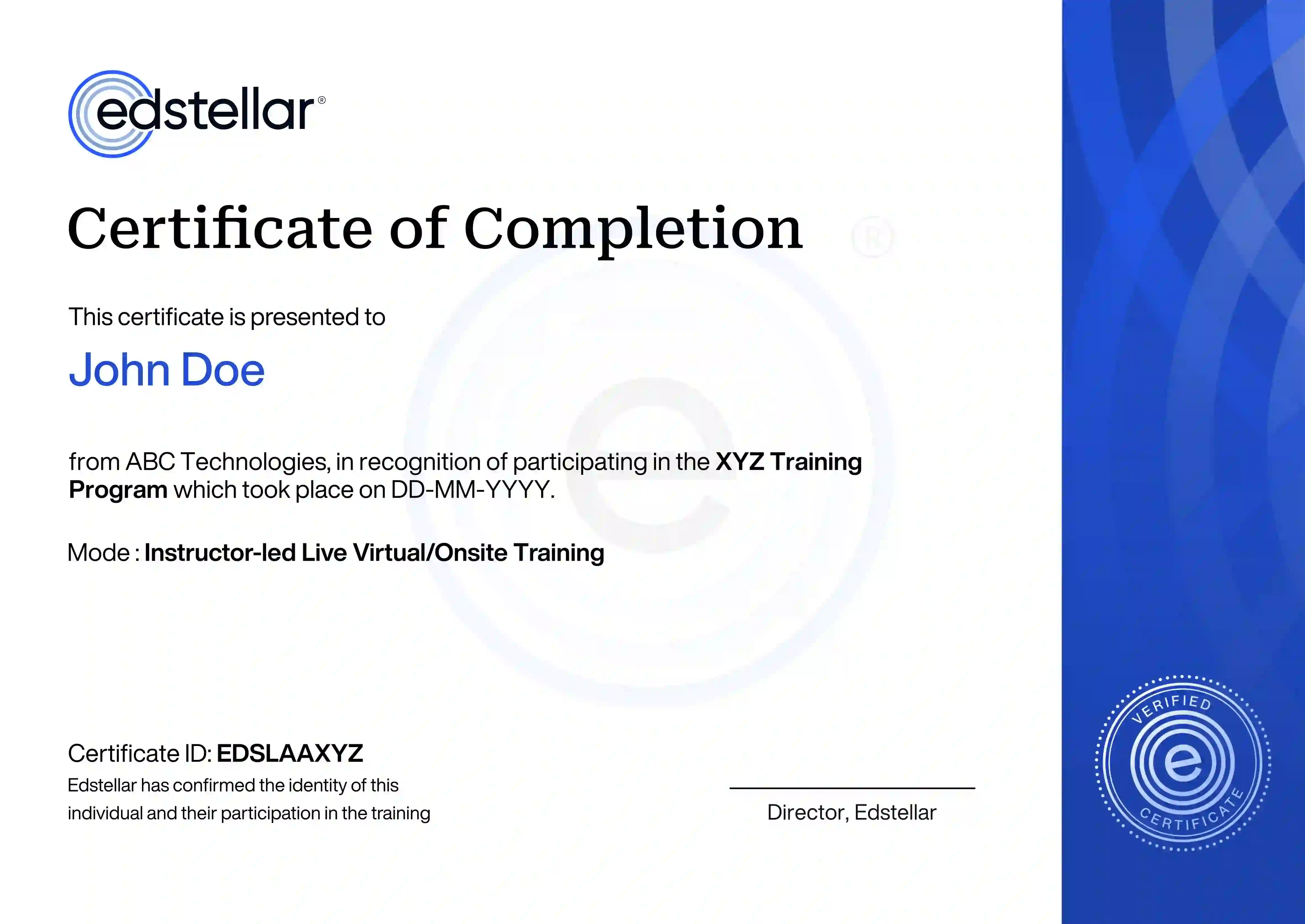
Upon successful completion of the training course offered by Edstellar, employees receive a course completion certificate, symbolizing their dedication to ongoing learning and professional development.
This certificate validates the employee's acquired skills and is a powerful motivator, inspiring them to enhance their expertise further and contribute effectively to organizational success.

Edstellar is a one-stop instructor-led corporate training and coaching solution that addresses organizational upskilling and talent transformation needs globally.
Marketing Excellence
Operational Excellence
Finance Excellence
HR Excellence
IT Excellence
Customer Service
Leadership Excellence
Quality Management
Software
How it WorksFAQ'sCorporate Training
CatalogStellar AI
Skill MatrixHRMS Integration
Who we ServeCEO RetreatsPricingTraining DeliveryPartner with Edstellar
CareersContact us