

Drone (UAS) Operations, Mapping and Inspection Corporate Training
Turn aerial data capture into your team's field advantage with practical, instructor-led drone operations training.
Give your enterprise teams the UAS flight and aerial data skills that turn drone operations into reliable field results. Edstellar's Drone (UAS) Operations, Mapping & Inspection corporate training helps your operators master compliant flight operations, photogrammetry mapping, and industrial inspection workflows through instructor-led sessions with real-world use cases. As the corporate training company enterprises trust for emerging-technology programs, we tailor every workshop to your assets, sites, and goals.
Instructor-led group trainingVirtual / on-site / off-site10 languagesDelivered inEnglish, Spanish, Mandarin, German, Arabic, Portuguese, Hindi, French, Japanese, Italian100+ countriesWe have delivered inUnited States, United Kingdom, India, Canada, Germany, France, Netherlands, UAE, Saudi Arabia, Singapore, Australia, Japan, Brazil, South Africa and 90+ more countries
How we build aerial-ready drone teams
THE EDSTELLAR DRONE OPERATIONS CAPABILITY MODEL
Baseline flight skills
Skill assessments reveal where your operators stand on regulations, flight control, and data capture.
Set one flight standard
One shared operating standard for flight planning, safety checks, and data workflows.
Fly and capture in labs
Supervised hands-on labs: flight drills, mapping missions, and inspection exercises.
Prove the mission lift
Lab assessments and deliverable reviews show capability rising flight by flight.
Scale across your sites
One standard rolls out across crews, sites, and regions as your drone program grows.





Need more than one program?Get a group quote
Trusted as a Leading Corporate Training Provider by
















Program Overview: What is Drone (UAS) Operations, Mapping and Inspection Corporate Training?
Drone (UAS) Operations, Mapping & Inspection builds enterprise teams that fly drones for aerial mapping and industrial inspection work. It is designed for surveyors, inspection engineers, and asset managers who need reliable aerial data without outsourcing every flight. The program covers flight planning, manual and automated flight, photogrammetry, sensors and payloads, inspection workflows, and data processing.
Training runs over 24 hours with substantial stick time. Teams fly manual and automated missions in the flight lab, plan risk-assessed operations, and process real captured data through photogrammetry pipelines. Instructors with commercial inspection experience review every flight plan and data product, pushing for survey-grade accuracy. Practice builds through mapping and inspection scenarios where teams troubleshoot poor data and re-fly missions. The program closes with a three-hour end-to-end UAS mission capstone, from planning to delivered data product.
Most in-house drone efforts produce pretty pictures that engineers cannot use: uncalibrated data, missed coverage, and inspections that need re-flying. The hardware is easy; the workflow is not. This program teaches teams the full chain from flight plan to deliverable, so every mission returns data the business can trust.
The capstone is an end-to-end UAS mission: teams plan, fly, and process a complete mapping or inspection job, delivering a finished data product judged on accuracy and completeness. Your people leave with a repeatable mission workflow they can run on their own assets immediately.
Drones survey faster, safer, and cheaper than ground crews, but only with disciplined operations. Without a standard, teams risk noncompliant flights, poor data, and rework. This program builds one shared operating standard, from pre-flight checks to final deliverables, so every mission produces data you can trust.
Across eight modules, your operators move from regulations to a full capstone mission. Every lab uses your use cases, so skills transfer straight to the field.
What's Included in this Workshop for Your Enterprise Teams
- 1
UAS regulations and flight planning
Rules, airspace, and mission planning essentials.
- 2
Manual and automated flight labs
Supervised flight drills and waypoint missions.
- 3
Mapping and photogrammetry labs
Orthomosaics, 3D models, and map products.
- 4
Inspection workflows and reporting
Asset inspections and defect documentation.
- 5
Skills assessment and certification
Baseline-to-capstone measurement of flight skill.
- Training delivered at any of your offices globally
- 10+ languages
- Schedule around your calendar
- Group size set along with you
- Run as one cohort or split into batches
- Instructor-led (virtual/onsite/hybrid)
- Recurring and annual options
- Trainer sourcing, matching and logistics
Build your team's skills. Anywhere in the world.
Real-world use cases
from day one
Instructor-led training
for your teams
Delivered globally
in 100+ countries


Enterprise Training Solutions Customized for Your Company
One partner for instructor-led corporate training, delivered the way your teams work.
Request a Training Quote- Customized Training Delivery
- Scale Your Training: Small to Large Teams
- In-person Onsite, Live Virtual or Hybrid Training Modes
- Plan from 2000+ Industry-ready Training Programs
- Hands-On Labs on Live Infrastructure, Led by Industry Experts
Drone (UAS) Operations, Mapping and Inspection Course Topics and Program Outline
Eight modules follow a clear learning path from UAS regulations and flight planning to mapping, inspection, and a full capstone mission. Each session builds on the last, with hands-on labs that turn flight hours into reliable field data.
Built by Edstellar with drone operations practitioners
Built by pilots and UAS operators who fly mapping and inspection missions in production, shaped around your stack and use cases.
Baseline each participant's drone operations readiness before module 01 begins
Build strong drone operations foundations in instructor-led sessions for your team
Reinforce skills through guided hands-on labs on drone mapping and inspection flights
Apply drone operations skills to real-world scenarios and a capstone flight project
A short pre-training assessment sets each participant's entry level, so the program starts where your team actually is. The rest is weighted toward hands-on practice: drone flight labs, photogrammetry and mapping exercises, and realistic scenarios drawn from your team's work, not slides.
Delivered as
Entry level set by the assessment. Depth and schedule customized to your team.

Test your baseline knowledge of aircraft systems, airspace rules, and operator responsibilities with a short skills check.
learna)UAS types and aircraft systems
b)Airspace classifications and restrictions
c)Registration, certification, and waivers
d)Operator responsibilities and safety culture
Plan a compliant commercial mission: review NOTAMs, assess weather, and complete a full pre-flight checklist.
practicea)Pre-flight checklists and risk assessment
b)Flight planning tools and NOTAM review
c)Weather analysis for UAS missions
d)Battery management and endurance planning
e)Contingency and emergency procedures
Fly supervised manual maneuvers and build autonomous waypoint missions with GPS fail-safes and return-to-home.
practicea)Flight controls and core maneuvers
b)GPS modes, sensors, and fail-safes
c)Autonomous waypoint mission design
d)Beyond visual line of sight concepts
e)Night and complex-environment operations
Design a mapping mission, fly it, and process the imagery into an orthomosaic and 3D point cloud.
practicea)Mapping mission design and overlap
b)Ground control points and RTK/PPK positioning
c)Photogrammetry workflows and orthomosaics
d)3D models and point clouds
e)Accuracy assessment and quality checks
Compare RGB, thermal, LiDAR, and multispectral payloads and select the right sensor for a given inspection task.
learna)Sensor types: RGB, thermal, LiDAR, multispectral
b)Payload integration and calibration
c)Data capture settings per sensor
d)Selecting sensors for your use cases
Run a full inspection workflow on a mock asset: plan, capture, annotate defects, and deliver a report.
practicea)Inspection planning for infrastructure assets
b)Towers, turbines, and solar inspection techniques
c)Damage detection and defect annotation
d)Inspection reporting and documentation
e)Repeat surveys and change detection
Process captured data into client-ready deliverables and integrate map products with your GIS.
practicea)Processing chains: capture to deliverable
b)GIS integration and map products
c)Sharing data with stakeholders
d)Data storage, privacy, and retention
Plan, fly, capture, and process a full mission, then present your deliverables and program rollout plan.
applya)Mission brief and site analysis
b)Integrated flight, capture, and processing
c)Deliverable presentation and review
d)Program rollout planning for your organization
Customize this program tailored to your team?
Tell us your training needs: what your team already works with, the level they’re at, and the topics you want them to focus on. We’ll adjust the modules, duration and hands-on labs, and send you a customized outline for your group.
Key Skills and Outcomes Your Team Will Gain
Your team will leave able to plan, fly, map, and inspect with unmanned aircraft systems. Each outcome is practiced in hands-on labs and shown in the capstone mission.
Plan compliant UAS missions
Build flight plans that satisfy airspace rules, weather limits, and site constraints before takeoff.
Fly manual and automated missions
Handle manual maneuvers and program autonomous waypoint flights with working fail-safes.
Produce survey-grade maps
Capture imagery and process orthomosaics, 3D models, and point clouds to stated accuracy.
Select the right sensor payload
Match RGB, thermal, LiDAR, or multispectral sensors to inspection and mapping tasks.
Run asset inspections end to end
Inspect towers, turbines, and solar assets, annotate defects, and document findings.
Process and deliver aerial data
Turn raw captures into GIS-ready deliverables stakeholders can use immediately.
Run a disciplined drone program
Apply checklists, risk assessments, and reporting that keep every mission safe and auditable.
Teams that Benefit from this Drone (UAS) Operations, Mapping and Inspection Group Training
This program is built for teams that fly or manage drones at work: operators, surveyors, inspectors, and the managers who own the program. Content adapts to each cohort's assets and use cases, so field crews and managers practice the missions their roles actually own.
Map sites faster with survey-grade aerial data.
Surveyors and GIS staff master mission design, ground control, and photogrammetry so aerial maps meet the accuracy your projects demand.
Workflow friction
- Ground surveys take too long on large sites
- Map accuracy is hard to prove to clients
- GIS teams cannot keep up with survey demand
How the program helps
- Cut survey time on large sites
- Deliver accuracy-checked map products
- Feed GIS with fresh aerial data
Practice use cases
- Topographic surveys
- Progress mapping
- Site audits
Inspect assets without the climbs, shutdowns, or scaffolds.
Inspection teams learn UAS workflows for towers, turbines, solar, and industrial assets, with defect annotation and repeat-survey discipline.
Workflow friction
- Rope access and scaffolding are costly
- Defects get missed between inspections
- Inspection reports lack visual evidence
How the program helps
- Inspect faster with less downtime
- Catch defects with repeatable flights
- Document every finding with imagery
Practice use cases
- Tower inspections
- Turbine checks
- Solar farm surveys
Run a compliant, auditable drone program.
Managers own the operating standard: regulations, risk assessments, checklists, and reporting that keep missions compliant across sites.
Workflow friction
- Regulatory rules keep changing
- No standard flight procedure across crews
- Flight data is scattered and untracked
How the program helps
- Keep every flight compliant
- Standardize procedures across crews
- Track missions and data centrally
Practice use cases
- Program rollout
- Compliance reviews
- Crew training
Each cohort trains on your sites and assets, then leaves with a flight standard ready for day-to-day operations.
Prerequisites: No prior flight experience is required. Basic comfort with technology and fieldwork helps, and content adapts to each cohort's experience. What matters most is a role that touches drone operations: operators, surveyors, inspectors, or managers who will own the program. Where local rules require it, we guide your team through registration and certification steps alongside the program.
Field Technician to UAS Operations Lead
The program takes operators from compliant flight basics to boardroom-ready mission delivery: foundation regulations, intermediate mapping and sensor work, then advanced inspection workflows and a capstone mission.
Operators grow from compliant flight basics to owning full mapping and inspection missions as the modules progress.
Mixed cohort, or several teams at once?
We can tailor the training to different teams, roles, and experience levels within the same program.
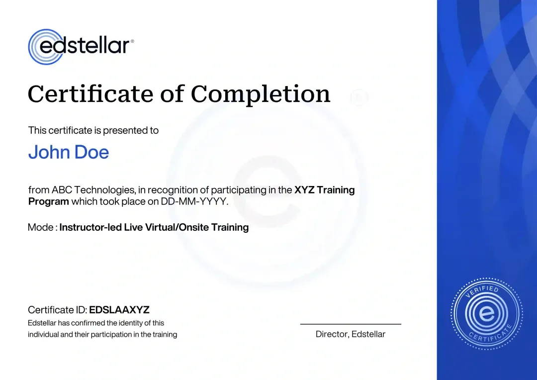
Certificate of Training Completion.
On successful completion, employees receive an Edstellar course completion certificate, recognizing their commitment to ongoing learning and professional development. It validates the skills they have built and motivates them to keep growing and contribute to organizational success.
Earned, not attended. Awarded on completion of all hands-on labs and the capstone project.
Training Delivery Modes: Virtual, Onsite and Hybrid
Every mode is shaped around your sites and use cases before delivery. The curriculum, hands-on labs, and capstone stay the same in each format, so what your operators can do after training never depends on how you run it.
Hybrid Training
Live instruction across office and remote sessions, with supervised hands-on labs coached throughout. Your operators plan missions, fly drills, and process aerial data with instructor guidance. Best for multi-site teams.
- Live instruction across office and remote sessions
- Supervised hands-on labs with instructor coaching
- Real-world mapping and inspection exercises
- Best for teams across sites and time zones

Onsite Training
Your instructor delivers at your facility, with flight and mapping drills set up for your team. Operators fly drills, capture data, and process deliverables with direct coaching. Best for co-located teams.
- Instructor delivers at your facility
- Labs set up for your team and assets
- Direct coaching during flight exercises
- Best for co-located teams wanting maximum interaction

Live Virtual Training
Live virtual sessions on Zoom or Microsoft Teams, with remote lab exercises and screen-shared guidance through every task. Your operators plan missions and process data together in real time. Best for distributed teams.
- Live sessions on Zoom or Microsoft Teams
- Remote access to the lab environment
- Screen-shared guidance through every task
- Best for distributed operator teams

Need a training format that works for your team?
Full days, half days across weeks, or split by module. Tell us the delivery window and we schedule the cohort around it.
Learn from industry experts.
Every session is led by a practitioner who has run monitoring for models in production, not a generalist working from slides.

Bashir
Career Counselling Trainer in Karachi
8+ years of Experience

Chandrasekhar
Blockchain Technology Trainer in Hyderabad
7+ years of Experience

Monushus
Data Analytics Trainer in Kanniyakumari
7+ years of Experience

Manjari
Certified Blockchain Trainer in Coimbatore
8+ years of Experience

Vishu
Adobe and Unity3D Trainer in Gurgaon
16+ years of Experience
Trainers are matched to your stack and delivery window at scheduling. We confirm your assigned trainer, with a full profile, before the program is booked.
Frequently Asked Questions
Share your team size, preferred dates, and delivery mode in the lead form. We reply with a tailored proposal covering scope, schedule, and pricing for your group.
Both. Choose live virtual sessions on Zoom or Teams, onsite delivery at your office, or a hybrid mix across sites and time zones.
The standard program runs 24 hours of instructor-led sessions with 8 hands-on labs, typically over three days. We can reshape the schedule around your calendar.
We recommend 8 to 12 operators per cohort so everyone gets flight time in the labs. Larger teams can run as parallel batches.
Yes. We shape missions, mapping examples, and the capstone around your sites, assets, and inspection targets before delivery.
Question not answered here?
Put it in the request. A training specialist answers it directly, within one business day.
Where this Training Fits in Your Team's learning path.
This course is where drone work begins. Your team learns to fly, map, and inspect within line of sight, then scales up with BVLOS approval, analyses the remote sensing data the flights produce, and feeds it into structured asset inspection programmes.




Why Choose Edstellar as Your Drone (UAS) Operations, Mapping and Inspection Enterprise Training Provider
If your team needs to fly, map, and inspect with confidence, start here. Tell us about your assets, sites, and preferred delivery mode, and we will shape a program around them.

EXPERT TRAINERS
YEARS DELIVERING
ORGANIZATIONS TRAINED
CERTIFIED
Tailored
Content shaped around your UAS operations and mapping & inspection use cases, so every session maps to your real UAS operations needs.
Proven Methodology
5+ years delivering corporate training to survey, geospatial and inspection crews across industries and regions.
Practice-Based Learning
8 hands-on labs across 8 modules. Your team builds flight plans, maps and inspection reports with instructor guidance.
Expert Trainers
5,000+ certified trainers matched to your UAS tools, with a full trainer profile shared before your program is booked.
Global Scale
One drone mapping and inspection program across your offices worldwide, in hybrid, onsite, or live virtual.
Measurable Outcomes
Baseline-to-capstone measurement and Skills Matrix reporting keep your drone mapping capability lift visible.
Also from Edstellar
Talent assessments
Psychometric, behavioral, leadership and 360-degree assessment.
→Training needs analysis
Needs analysis, gap identification, and a training roadmap.
→L&D consulting
Learning strategy, content, technology and ROI measurement.
→OD consulting
Org design, succession planning and cultural change.
→Managed training services
Training outsourcing, vendor management, logistics and administration.
→Coaching solutions
Executive and manager coaching that keeps skills in use.
Start an RFP shaped to your needs.
Answer three quick questions about team size, scope, and how often you need the program run, then send the request from the last step. Everything you choose travels with it, so you only fill this in once.
How many team members need training?
Drone (UAS) Operations, Mapping & Inspection Training Packages & Pricing
Where L&D holds an annual budget, license packages price the whole year at once instead of raising a purchase order per workshop. Hours and licenses are pooled across teams, programs and locations, so unused capacity is not stranded in one department.
Starter
120
trainee licenses64 hours of group training
Tailored for SMBs
Growth
320
trainee licenses160 hours of group training
Ideal for growing SMBs
Enterprise
800
trainee licenses400 hours of group training
Designed for large corporations
Custom
Unlimited
trainee licensesDuration set by the rollout
Multi-region and multi-year
Training Packages & Pricing
Choose the training format that works for your team. Pricing is customized based on your requirements, cohort size, and delivery needs.
Request Drone (UAS) Operations, Mapping and Inspection Training for Your Team
Share your team size, assets, preferred delivery mode, and timelines. We will respond with a tailored training plan covering scope, schedule, and pricing, and confirm trainer availability.