

Spatial Analysis and Satellite Imagery in a GIS Corporate Training
Instructor-led Spatial Analysis training for engineering teams working with satellite imagery and GIS.
This instructor-led Spatial Analysis and Satellite Imagery in a GIS corporate training program gives your engineering teams the skills to source and preprocess satellite imagery, run spatial analysis workflows, classify land cover, and detect change. Through guided hands-on labs, your team practices overlay analysis, suitability modeling, classification, and map production on real datasets. The program closes with a capstone where your team delivers an end-to-end imagery intelligence project, so analysis becomes decision-ready maps.
Instructor-led group trainingVirtual / on-site / off-site10 languagesDelivered inEnglish, Spanish, Mandarin, German, Arabic, Portuguese, Hindi, French, Japanese, Italian100+ countriesWe have delivered inUnited States, United Kingdom, India, Canada, Germany, France, Netherlands, UAE, Saudi Arabia, Singapore, Australia, Japan, Brazil, South Africa and 90+ more countries
How we build a map-ready analysis team
The Edstellar GEOSPATIAL INTELLIGENCE Capability Model
Diagnose
Assess your current GIS skills, imagery access, and the analysis gaps slowing your projects.
Standardize
Define imagery workflows, analysis models, and map standards your teams share.
Practice
Run guided labs on real imagery covering analysis, classification, and change detection.
Measure
Track lab outcomes and capstone results against your team's project objectives.
Scale
Roll the program to more teams with consistent curriculum and shared workflow templates.





Need more than one program?Get a group quote
Trusted as a Leading Corporate Training Provider by
















Program Overview: What is Spatial Analysis and Satellite Imagery in a GIS?
Spatial Analysis & Satellite Imagery in a GIS is Edstellar's instructor-led technical program for engineering and planning teams that work with spatial data and satellite imagery. Participants cover GIS foundations, imagery sources and preprocessing, spatial analysis workflows, modeling and classification, change detection, and map production. The program closes with a capstone: an end-to-end imagery intelligence project.
Training is hands-on across all 24 hours, with the team working real imagery in guided labs. Participants source and preprocess satellite data, run spatial analysis workflows, build classification and change detection models, and produce publication-standard maps in supervised sessions. Instructors review every analysis and map with direct feedback, coaching the technical judgment behind each methodological choice. The 5-hour capstone delivers a complete imagery intelligence project, from raw pixels to decision-ready maps.
Imagery projects often stall between data and decision: beautiful rasters, analyses nobody trusts, and maps that answer the wrong question. This program teaches the full intelligence workflow: choose the right imagery, process it rigorously, analyze with method, and present what decision makers need. Every technique is practiced on real data, so the team's analyses hold up under scrutiny.
The imagery intelligence capstone is the job in miniature: take raw satellite data, preprocess it, run classification and change detection, and deliver maps and analysis a decision maker can act on. Reviewed by practitioners and defended by the team, the project proves the workflow end to end. The team returns with a tested method and the confidence to run it on the questions that matter.
Your team starts with GIS foundations and spatial data essentials, then moves through imagery sourcing and preprocessing in guided labs. Later modules cover spatial analysis workflows, classification, change detection, and cartographic design standards. The program closes with a capstone where your team delivers an end-to-end imagery intelligence project with decision-ready maps.
What's Included in this Workshop for Your Enterprise Teams
- 1
GIS foundations
Coordinate systems, data models, and platform essentials.
- 2
Imagery preprocessing
Sourcing, correction, and analysis-ready imagery stacks.
- 3
Analysis workflows
Overlay, proximity, suitability, and network analysis.
- 4
Classification and change
Land cover classification and change detection.
- 5
Capstone build
Deliver an end-to-end imagery intelligence project.
- Instructor-led sessions, virtual, onsite, or hybrid
- 24 hours of guided hands-on labs
- Lab guides and workflow references
- Tailored examples from your projects
- Capstone build with instructor review
- Post-program rollout support
Build your team's skills. Anywhere in the world.
Real-world use cases
from day one
Instructor-led training
for your teams
Delivered globally
in 100+ countries


Enterprise Training Solutions Customized for Your Company
One partner for instructor-led corporate training, delivered the way your teams work.
Request a Training Quote- Customized Training Delivery
- Scale Your Training: Small to Large Teams
- In-person Onsite, Live Virtual or Hybrid Training Modes
- Plan from 2000+ Industry-ready Training Programs
- Hands-On Labs on Live Infrastructure, Led by Industry Experts
Spatial Analysis and Satellite Imagery in a GIS Course Topics and Program Outline
A 24-hour instructor-led program that takes your team from GIS foundations to an end-to-end satellite imagery intelligence project.
Built by Edstellar with geospatial engineering practitioners
Built by practitioners who deliver geospatial projects in production, shaped around your platform and use cases.
We map your team's GIS skills, imagery experience, and analysis needs so labs target your real projects.
Instructor-led sessions with live demos cover spatial data models, imagery sources, and preprocessing.
Guided labs where your team runs spatial analysis, classifies imagery, and detects change on real data.
A capstone build where your team delivers an end-to-end imagery project with decision-ready maps.
24 hours of guided hands-on labs plus an end-to-end imagery intelligence capstone project.
Delivered as
Delivered virtual, onsite, or hybrid to fit your team's schedule. Labs run on real imagery so skills transfer directly.

Set up a GIS workspace, load spatial datasets, and verify projections in a guided lab.
learna)Coordinate systems and projections
b)Vector and raster data models
c)GIS platform navigation and tooling
d)Sourcing and validating spatial data
Preprocess a satellite scene from raw download to analysis-ready raster stack.
learna)Optical, radar, and multispectral sources
b)Resolution, revisit, and licensing trade-offs
c)Radiometric and geometric correction
d)Mosaicking and clipping workflows
e)Building analysis-ready imagery stacks
Build a suitability model for site selection using overlay and proximity tools.
practicea)Overlay and proximity analysis
b)Interpolation of sparse observations
c)Suitability and site selection models
d)Network and accessibility analysis
e)Automating workflows with model builders
Classify land cover and run change detection on a two-date imagery pair.
practicea)Supervised and unsupervised classification
b)Spectral indices for vegetation and water
c)Change detection across image pairs
d)Accuracy assessment with ground truth
e)Tuning models for operational use
Produce a publication-quality map series from your analysis results to design standards.
applya)Cartographic design principles
b)Symbology and classification breaks
c)Layout templates and style standards
d)Map series and atlas production
e)Publishing web maps and services
Deliver an end-to-end imagery intelligence project with maps and a stakeholder briefing, reviewed by the instructor.
applya)Project scoping and data sourcing
b)Preprocessing and analysis pipeline
c)Classification and change reporting
d)Map production to design standards
e)Capstone review and stakeholder presentation
Customize this program tailored to your team?
Tell us your training needs: what your team already works with, the level they’re at, and the topics you want them to focus on. We’ll adjust the modules, duration and hands-on labs, and send you a customized outline for your group.
Key Skills and Outcomes Your Team Will Gain
Practical spatial analysis capabilities your team practices in labs and demonstrates in the capstone build.
Spatial Data Fundamentals
Explain coordinate systems, projections, and vector versus raster models.
Imagery Sourcing and Preprocessing
Choose imagery sources and preprocess scenes into analysis-ready stacks.
Spatial Analysis Workflows
Run overlay, proximity, interpolation, and suitability analyses.
Image Classification
Classify land cover from multispectral imagery with validated methods.
Change Detection
Detect and quantify change across multi-date imagery pairs.
Cartographic Map Production
Produce publication-quality maps to professional design standards.
Imagery Project Delivery
Deliver an end-to-end imagery project with maps and a stakeholder briefing.
Teams that Benefit from this Spatial Analysis and Satellite Imagery in a GIS Group Training
This program is built for engineering and planning teams that work with spatial data and satellite imagery. Content adapts to each cohort's GIS platform, data, and project types, so every team practices the workflows it owns.
Turn satellite imagery into decision-ready maps
Geospatial teams standardize imagery workflows, analysis models, and map production so every project delivers consistent quality.
Workflow friction
- Ad-hoc analysis methods
- Inconsistent map outputs
- Unvalidated classifications
How the program helps
- Standardized imagery workflows
- Repeatable analysis models
- Consistent map quality
Practice use cases
- imagery pipelines
- analysis models
- map standards
Plan cities with current spatial intelligence
Planning teams use current imagery and suitability models to site facilities, plan growth, and defend decisions with evidence.
Workflow friction
- Outdated base maps
- Weak site justification
- Slow plan updates
How the program helps
- Evidence-based site selection
- Current growth monitoring
- Defensible planning reports
Practice use cases
- site selection
- growth monitoring
- planning maps
Monitor change with repeatable analysis
Environmental teams detect land cover change, track vegetation and water, and report trends with validated methods.
Workflow friction
- Unmeasured land change
- One-off analysis efforts
- Unvalidated results
How the program helps
- Validated change detection
- Repeatable monitoring
- Trusted trend reports
Practice use cases
- change detection
- trend monitoring
- validation
Design networks on accurate spatial data
Infrastructure teams route networks, assess corridors, and plan maintenance using accurate, current spatial analysis.
Workflow friction
- Stale network records
- Poor corridor data
- Reactive maintenance
How the program helps
- Accurate corridor analysis
- Current network maps
- Data-driven maintenance plans
Practice use cases
- corridor analysis
- network mapping
- maintenance planning
Departments are starting points; cohorts are shaped around your actual platform and project mix.
Prerequisites: Geospatial engineers, planners, and environmental analysts benefit most. Familiarity with basic GIS concepts helps but is not required; no prior satellite imagery experience is needed. The program adapts to each cohort's tools and context.
Analyst to geospatial project owner
Each skill row maps to the modules where it is taught, so your team sees exactly how capability builds from foundations to the capstone.
One program that grows with geospatial careers, from data basics to confident imagery project delivery.
Mixed cohort, or several teams at once?
We can tailor the training to different teams, roles, and experience levels within the same program.
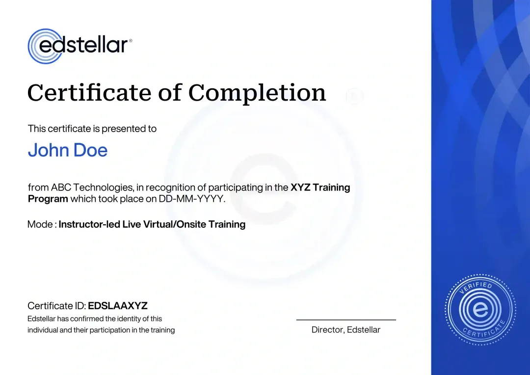
Certificate of Training Completion.
On successful completion, employees receive an Edstellar course completion certificate, recognizing their commitment to ongoing learning and professional development. It validates the skills they have built and motivates them to keep growing and contribute to organizational success.
Earned, not attended. Awarded on completion of all hands-on labs and the capstone project.
Training Delivery Modes: Virtual, Onsite and Hybrid
Every delivery mode is instructor-led and lab-driven, so your team gets the same hands-on spatial analysis practice wherever they learn.
Hybrid Training
Split sessions between your office and remote joiners, with shared labs so every participant builds the same skills.
- Live instructor across office and remote cohorts
- Shared lab environments for every participant
- Flexible scheduling around delivery calendars
- Same curriculum and capstone in every mode

Onsite Training
Our instructor joins your team onsite for focused lab days, whiteboard design sessions, and direct coaching.
- Instructor-led sessions at your location
- Whiteboard design of your analysis workflows
- Team pairing during guided labs
- Direct coaching on your GIS setup

Live Virtual Training
Live virtual sessions with an instructor, breakout labs, and real-time help across every module.
- Live instructor-led virtual classroom
- Breakout rooms for guided lab work
- Real-time help during every lab
- Recordings and lab guides for review

Need a training format that works for your team?
Full days, half days across weeks, or split by module. Tell us the delivery window and we schedule the cohort around it.
Frequently Asked Questions
Share your team size and preferred dates through the request form and our advisors will send a tailored proposal within one business day.
Yes. A short discovery call helps us map your GIS stack and imagery needs so the program targets your real projects.
Yes. Live virtual sessions include breakout labs and real-time instructor help, with recordings for review.
Yes. Our instructor joins your team onsite for focused lab days and whiteboard design of your analysis workflows.
The program runs 24 hours, typically across four days, with guided labs in every module and a capstone project build.
Question not answered here?
Put it in the request. A training specialist answers it directly, within one business day.
Where this Training Fits in Your Team's learning path.
Satellite imagery analysis builds on knowing how location data answers business questions. Your team learns location analytics first, then analyses satellite imagery in a GIS in this course, scales to Earth observation analytics, and finishes with GeoAI to automate image analysis.




Why Choose Edstellar as Your Spatial Analysis and Satellite Imagery in a GIS Corporate Training Provider
Edstellar delivers instructor-led Spatial Analysis training shaped around your platform, your data, and your project goals.

EXPERT TRAINERS
YEARS DELIVERING
ORGANIZATIONS TRAINED
CERTIFIED
Tailored
Examples, datasets, and the capstone are shaped around your GIS platform, imagery needs, and project types.
Proven Methodology
A learn, practice, apply arc moves your team from GIS basics to an end-to-end imagery project in 24 hours.
Practice-Based Learning
Five guided lab modules on real satellite imagery build real analytical skill, not slide knowledge.
Expert Trainers
Instructors who deliver geospatial projects in production bring field-tested judgment to every session and lab.
Global Scale
We deliver to distributed teams across time zones with consistent curriculum and shared lab standards.
Measurable Outcomes
Lab reviews and the capstone project show exactly what your team can analyze, classify, and map after the program.
Turn Satellite Imagery Into Defensible Spatial Analysis and Clear Maps
Edstellar develops imagery-analysis capability through a complete GIS workflow. Participants prepare satellite scenes, apply spatial and classification methods, investigate change, and communicate findings through maps. A stakeholder briefing is reviewed alongside analytical outputs for reproducibility, appropriate interpretation, and clear presentation of spatial evidence and limitations.
- Step 01
Consult
We discuss GIS familiarity, spatial-analysis responsibilities, and imagery questions to identify support needed for preprocessing, classification, change detection, and cartographic communication.
- Step 02
Plan
Spatial-data foundations lead into imagery sourcing and preparation, analysis, modeling, and change detection before map production and an end-to-end imagery project.
- Step 03
Align
Geospatial analysis expertise supports engineers, planners, and environmental analysts, building imagery foundations while connecting technical choices with their intended decision-making use.
- Step 04
Customize
Open or sample satellite scenes and fictional analysis briefs provide relevant spatial questions without exposing restricted location data or assuming access to proprietary imagery.
- Step 05
Execute
Participants prepare raster stacks, run analytical workflows, and produce map series, receiving feedback on preprocessing, interpretation, design standards, and the presentation of uncertainty.
- Step 06
Evaluate
We assess the project for a reproducible imagery workflow, supported spatial conclusions, appropriate classification or change evidence, and maps that communicate findings clearly.
Also from Edstellar
Talent assessments
Psychometric, behavioral, leadership and 360-degree assessment.
→Training needs analysis
Needs analysis, gap identification, and a training roadmap.
→L&D consulting
Learning strategy, content, technology and ROI measurement.
→OD consulting
Org design, succession planning and cultural change.
→Managed training services
Training outsourcing, vendor management, logistics and administration.
→Coaching solutions
Executive and manager coaching that keeps skills in use.
Start an RFP shaped to your needs.
Answer three quick questions about team size, scope, and how often you need the program run, then send the request from the last step. Everything you choose travels with it, so you only fill this in once.
How many team members need training?
Spatial Analysis & Satellite Imagery in a GIS Training Packages & Pricing
Where L&D holds an annual budget, license packages price the whole year at once instead of raising a purchase order per workshop. Hours and licenses are pooled across teams, programs and locations, so unused capacity is not stranded in one department.
Starter
120
trainee licenses64 hours of group training
Tailored for SMBs
Growth
320
trainee licenses160 hours of group training
Ideal for growing SMBs
Enterprise
800
trainee licenses400 hours of group training
Designed for large corporations
Custom
Unlimited
trainee licensesDuration set by the rollout
Multi-region and multi-year
Training Packages & Pricing
Choose the training format that works for your team. Pricing is customized based on your requirements, cohort size, and delivery needs.
Request Spatial Analysis and Satellite Imagery in a GIS Training for Your Team
Tell us about your team size, GIS platform, project types, and preferred dates. A training advisor will respond with a tailored plan and quote.