

Sustainable Urban Planning and Land Use Corporate Training
Instructor-led Sustainable Urban Planning & Land Use training for government teams shaping sustainable cities.
This instructor-led Sustainable Urban Planning & Land Use corporate training program gives your government teams the skills to design land use policy, run GIS-based scenario analysis, and deliver transit-oriented development plans. Through guided hands-on labs, your team practices suitability mapping, zoning design, stakeholder engagement, and implementation roadmapping. The program closes with a capstone where teams draft an integrated sustainable land use plan for a real growth corridor.
Instructor-led group trainingVirtual / on-site / off-site10 languagesDelivered inEnglish, Spanish, Mandarin, German, Arabic, Portuguese, Hindi, French, Japanese, Italian100+ countriesWe have delivered inUnited States, United Kingdom, India, Canada, Germany, France, Netherlands, UAE, Saudi Arabia, Singapore, Australia, Japan, Brazil, South Africa and 90+ more countries
How we build a land-use-ready planning team
The Edstellar SUSTAINABLE URBAN PLANNING Capability Model
Diagnose
Assess your city's growth pressures, land use mix, and the policy gaps slowing sustainable development.
Standardize
Align zoning codes, environmental rules, and approval workflows to a consistent sustainability standard.
Practice
Build suitability maps and transit-oriented designs in guided hands-on labs using real planning data.
Measure
Track density, emissions, equity, and uptake indicators that show whether land use policy is working.
Scale
Roll out proven planning playbooks across districts with repeatable stakeholder and financing models.





Need more than one program?Get a group quote
Trusted as a Leading Corporate Training Provider by
















Program Overview: What is Sustainable Urban Planning and Land Use?
Built for planners, public officials, and development teams, Sustainable Urban Planning & Land Use is Edstellar's instructor-led program on shaping cities that last. Participants cover urban development foundations, land use policy and regulatory frameworks, GIS-based analysis and scenario mapping, transit-oriented and mixed-use planning, and stakeholder engagement with implementation roadmaps. The program treats planning as technical craft and public process.
Across 24 hours and six modules, expert briefings alternate with guided planning exercises. Your team runs a GIS-based land use analysis, sketches a transit-oriented district concept, and drafts an implementation roadmap with instructor coaching and feedback throughout. Instructors review the planning logic the way a review board would. The program closes with a capstone: an integrated sustainable land use plan the team presents for critique.
Cities lock in decades of emissions and inequity in a single zoning decision, yet planning teams often work without practiced scenario tools. Plans stall between the vision document and the permit. This program teaches your people to analyze land use rigorously, design mixed-use and transit-served growth, and carry stakeholders through implementation.
Your team finishes with an integrated sustainable land use plan from the capstone: analysis, policy framework, district concepts, and an implementation roadmap with stakeholder strategy, reviewed by the instructor. It is a plan that can survive a council chamber, not just a classroom.
Teams learn to combine policy literacy with hands-on spatial analysis: zoning reform, transit-oriented development, green infrastructure, and brownfield reuse. Labs build practical muscle with suitability mapping, scenario comparison, and stakeholder-ready plan drafting, so the learning transfers directly to live planning work.
What's Included in this Workshop for Your Enterprise Teams
- 1
Planning foundations
Sustainable growth principles, density, and green infrastructure.
- 2
Policy and zoning
Land use codes, permits, and environmental alignment.
- 3
Spatial analysis
GIS-based suitability and scenario mapping labs.
- 4
Implementation
Stakeholder engagement, financing, and roadmaps.
- Instructor-led sessions, virtual, onsite, or hybrid
- 24 hours of guided hands-on planning labs
- Planning templates and policy references
- Tailored examples from your city context
- Capstone plan with instructor review
- Post-program rollout support
Build your team's skills. Anywhere in the world.
Real-world use cases
from day one
Instructor-led training
for your teams
Delivered globally
in 100+ countries


Enterprise Training Solutions Customized for Your Company
One partner for instructor-led corporate training, delivered the way your teams work.
Request a Training Quote- Customized Training Delivery
- Scale Your Training: Small to Large Teams
- In-person Onsite, Live Virtual or Hybrid Training Modes
- Plan from 2000+ Industry-ready Training Programs
- Hands-On Labs on Live Infrastructure, Led by Industry Experts
Sustainable Urban Planning and Land Use Course Topics and Program Outline
A 24-hour instructor-led program that takes your team from sustainable planning principles to a defensible integrated land use plan.
Built by Edstellar with urban planning and GIS practitioners
Built by practitioners who deliver land use plans and planning policy in production, shaped around your stack and use cases.
We map your team's planning maturity, data readiness, and priority growth corridors so the program targets real work.
Your team learns sustainable growth principles, zoning frameworks, and the policy levers that shape land use outcomes.
Guided hands-on labs build GIS suitability maps and transit-oriented designs using real planning data and scenarios.
Teams draft, model, and defend an integrated sustainable land use plan in a 6-hour capstone with instructor review.
24 hours of guided hands-on planning labs plus an integrated land use plan capstone.
Delivered as
Delivered virtual, onsite, or hybrid to fit your team's schedule. Labs use your city's planning context so skills transfer directly.

Score sample districts against a sustainability checklist in a guided working session.
learna)Sustainability principles in urban planning
b)Density, sprawl, and their tradeoffs
c)Green infrastructure fundamentals
d)Equitable growth and social outcomes
e)Global case snapshots
Map a zoning amendment through approvals, identifying bottlenecks and stakeholders.
learna)Zoning and land use codes
b)Environmental regulation alignment
c)Permitting workflows and timelines
d)Policy impact assessment
e)Inter-agency coordination
Build a land suitability map for a growth area using layered spatial data.
practicea)Spatial data sources for planners
b)Layer-based suitability analysis
c)Growth scenario modeling
d)Heat and flood risk overlays
e)Presenting maps to decision makers
Design a transit-oriented corridor with land use mix, density targets, and access metrics.
practicea)Transit-oriented development principles
b)Mixed-use zoning design
c)Walkability and access metrics
d)Parking and curb management
e)Corridor design exercises
Draft an engagement plan and phased roadmap for a redevelopment proposal.
applya)Stakeholder mapping and analysis
b)Public consultation design
c)Financing instruments for land projects
d)Phasing, milestones, and governance
e)Monitoring indicators and review cycles
Draft and defend an integrated sustainable land use plan for a real growth corridor.
applya)Site selection and framing
b)Integrated plan drafting
c)Impact and feasibility modeling
d)Stakeholder presentation
e)Panel review and feedback
Customize this program tailored to your team?
Tell us your training needs: what your team already works with, the level they’re at, and the topics you want them to focus on. We’ll adjust the modules, duration and hands-on labs, and send you a customized outline for your group.
Key Skills and Outcomes Your Team Will Gain
Practical sustainable planning capabilities your team practices in hands-on labs and demonstrates in the capstone plan.
Sustainable Growth Literacy
Explain how density, land mix, and green infrastructure shape urban outcomes.
Zoning and Policy Analysis
Read land use codes and assess policy impact on development proposals.
GIS Suitability Mapping
Build layered suitability maps that support defensible land decisions.
Scenario Comparison
Model growth scenarios and compare tradeoffs with risk overlays.
Transit-Oriented Design
Design mixed-use corridors with walkability and access metrics.
Stakeholder Engagement
Run consultations that surface community and agency input effectively.
Integrated Plan Delivery
Draft, finance, and sequence a complete sustainable land use plan.
Teams that Benefit from this Sustainable Urban Planning and Land Use Group Training
This program is built for government teams that own land use, planning approvals, and urban development outcomes. Content adapts to each cohort's city context, data, and maturity, so every team practices the workflows it owns.
Design sustainable land use policy that survives review
Planning teams turn growth pressure into defensible zoning and corridor plans backed by spatial evidence.
Workflow friction
- Weak spatial evidence
- Slow approval cycles
- Inconsistent zoning decisions
How the program helps
- Evidence-backed zoning proposals
- Faster plan approvals
- Consistent policy standards
Practice use cases
- suitability mapping
- zoning reform
- corridor planning
Align infrastructure delivery with land use plans
Public works teams sequence roads, transit, and utilities with planned growth so investments land on time.
Workflow friction
- Misaligned project timing
- Siloed agency planning
- Costly late changes
How the program helps
- Sequenced capital projects
- Aligned agency delivery
- Lower rework costs
Practice use cases
- infrastructure phasing
- transit alignment
- capital planning
Embed resilience and emissions goals in land decisions
Environment teams bring climate risk and green infrastructure into every land use decision with measurable indicators.
Workflow friction
- Sidelined climate goals
- No shared indicators
- Unfunded green plans
How the program helps
- Climate-aligned land policy
- Tracked resilience metrics
- Fundable green projects
Practice use cases
- risk overlays
- green infrastructure
- emissions tracking
Balance housing delivery with sustainable growth
Housing teams use density and mixed-use tools to deliver homes without repeating sprawl patterns.
Workflow friction
- Housing vs sprawl tension
- NIMBY approval blocks
- Fragmented housing data
How the program helps
- Targeted density delivery
- Mixed-use housing pipelines
- Reduced sprawl pressure
Practice use cases
- density planning
- mixed-use housing
- approval strategy
Each department track uses the same 24-hour core, with labs tuned to the datasets and decisions that function owns.
Prerequisites: This program suits planners, engineers, and policy staff involved in land use and development. Familiarity with basic planning concepts helps but is not required, and no prior GIS experience is needed. Instructors calibrate examples and lab data to each cohort's city context, tools, and maturity, so beginners and experienced planners both progress.
Junior planner to lead planner
Move from planning basics to leading integrated land use programs with evidence, engagement, and delivery discipline.
A planning career path that grows with urban practitioners, from basics to confident practice
Mixed cohort, or several teams at once?
We can tailor the training to different teams, roles, and experience levels within the same program.
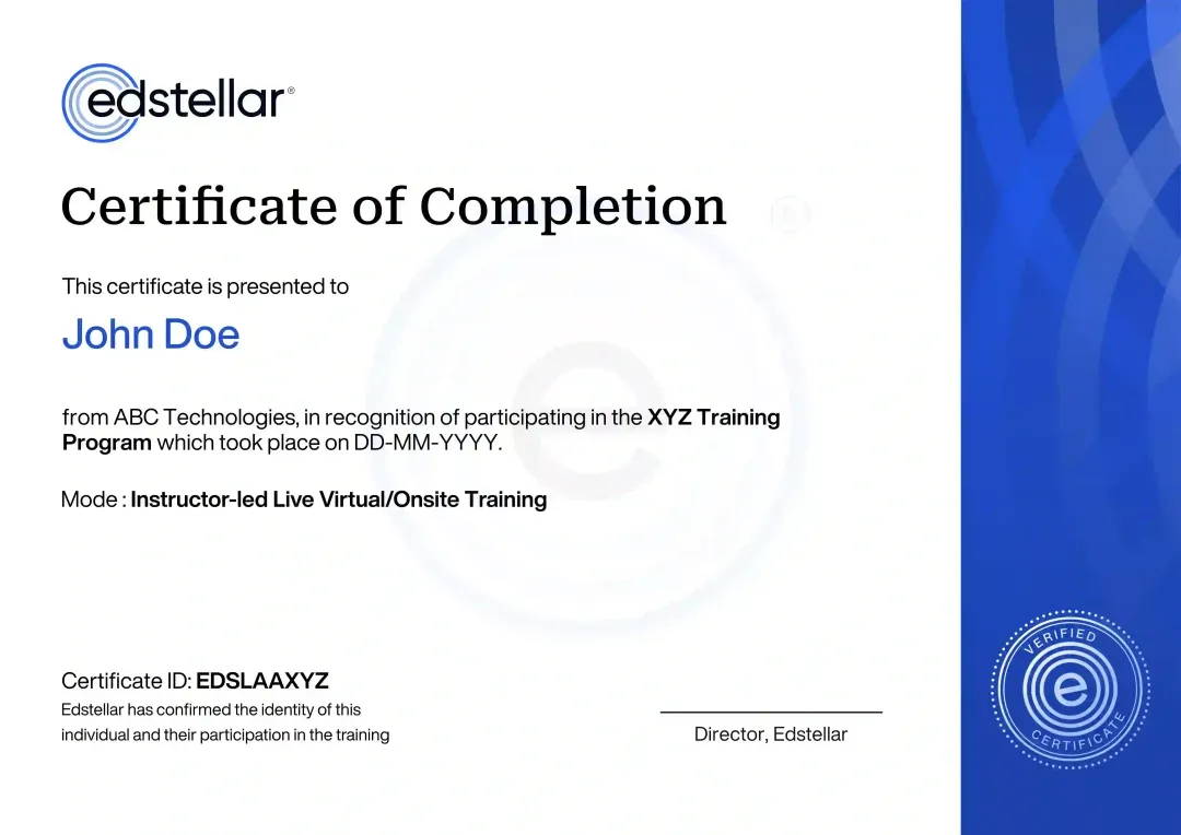
Certificate of Training Completion.
On successful completion, employees receive an Edstellar course completion certificate, recognizing their commitment to ongoing learning and professional development. It validates the skills they have built and motivates them to keep growing and contribute to organizational success.
Earned, not attended. Awarded on completion of all hands-on labs and the capstone project.
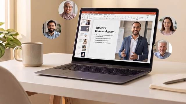
Training Delivery Modes: Virtual, Onsite and Hybrid
Every delivery mode is instructor-led and lab-driven, so your team gets the same hands-on planning practice wherever they learn.
Hybrid Training
Split sessions between your office and remote joiners, with shared spatial labs so every participant builds the same skills.
- Live instructor across office and remote cohorts
- Shared lab environments for every participant
- Flexible scheduling around planning calendars
- Same curriculum and capstone in every mode

Onsite Training
Bring the instructor to your planning department for face-to-face labs using your city's own datasets and corridors.
- Instructor at your office with your datasets
- Walk your priority corridors together
- Team workshops with live facilitation
- Capstone tuned to a live planning brief

Live Virtual Training
Join live online sessions with cloud-based GIS labs and breakout studios for collaborative plan design.
- Live virtual instructor and lab support
- Cloud GIS environments, no install needed
- Breakout studios for team design work
- Recorded sessions for review
Need a training format that works for your team?
Full days, half days across weeks, or split by module. Tell us the delivery window and we schedule the cohort around it.
Frequently Asked Questions
Share your team size and preferred dates through the request form and our advisors will send a tailored proposal within one business day.
Yes. A short discovery call helps us understand your planning context so we can shape the labs and capstone around your priorities.
Yes. Live virtual delivery includes cloud-based GIS labs, breakout studios, and the same capstone as onsite cohorts.
Yes. Onsite delivery uses your city's datasets and priority corridors, with the instructor working alongside your team.
The program runs 24 hours of instructor-led time, typically spread across three to four days depending on your schedule.
Question not answered here?
Put it in the request. A training specialist answers it directly, within one business day.
Where this Training Fits in Your Team's learning path.
Sustainable land use planning is the base for smarter, more resilient cities. Your team starts with it, then plans smart city projects, models the city with digital twins, and finally builds climate resilience into plans and infrastructure.




Why Choose Edstellar as Your Sustainable Urban Planning and Land Use Training Provider
Edstellar delivers instructor-led Sustainable Urban Planning & Land Use training shaped around your agencies, your city, and your delivery goals.

EXPERT TRAINERS
YEARS DELIVERING
ORGANIZATIONS TRAINED
CERTIFIED
Tailored
Examples, datasets, and the capstone are shaped around your city's corridors, codes, and planning priorities.
Proven Methodology
A diagnose-to-scale method refined across government planning teams keeps learning structured and practical.
Practice-Based Learning
Six hands-on labs build real planning muscle: GIS mapping, corridor design, and plan drafting with instructor review.
Expert Trainers
Practitioners who deliver urban plans for cities lead every session with real corridor stories and judgment.
Global Scale
Consistent delivery across regions and time zones keeps multi-city planning teams learning the same playbook.
Measurable Outcomes
Plan quality, approval speed, and indicator tracking show the return on your training investment clearly.
Develop Sustainable Land-Use Plans With Clear Spatial and Public-Process Evidence
Edstellar develops sustainable planning through policy, spatial analysis, and engagement exercises. Participants compare land-use scenarios, examine transit and mixed-use choices, and map approval and implementation steps. An integrated plan is reviewed for justified spatial decisions, coherent public-process arrangements, and a practical account of phasing and stakeholder needs.
- Step 01
Consult
We discuss planning responsibilities, policy familiarity, and development challenges to identify gaps in zoning analysis, GIS scenarios, transit-oriented design, and engagement planning.
- Step 02
Plan
Urban-development foundations lead into land-use policy, spatial analysis, and planning alternatives before stakeholder engagement and a complete integrated land-use plan.
- Step 03
Align
Urban-planning and policy expertise supports planners, engineers, and public-sector colleagues, connecting technical spatial choices with their responsibilities for approvals, consultation, and implementation.
- Step 04
Customize
A fictional growth corridor and sample zoning information provide realistic planning comparisons without using sensitive resident data or presuming approval of actual development.
- Step 05
Execute
Participants trace approval pathways, compare mapped scenarios, and develop engagement roadmaps, receiving feedback on spatial reasoning, dependencies, public participation, and implementation feasibility.
- Step 06
Evaluate
We assess the plan for coherent land-use and transport choices, supported scenario comparisons, clear stakeholder processes, and a justified phased implementation approach.
Also from Edstellar
Talent assessments
Psychometric, behavioral, leadership and 360-degree assessment.
→Training needs analysis
Needs analysis, gap identification, and a training roadmap.
→L&D consulting
Learning strategy, content, technology and ROI measurement.
→OD consulting
Org design, succession planning and cultural change.
→Managed training services
Training outsourcing, vendor management, logistics and administration.
→Coaching solutions
Executive and manager coaching that keeps skills in use.
Start an RFP shaped to your needs.
Answer three quick questions about team size, scope, and how often you need the program run, then send the request from the last step. Everything you choose travels with it, so you only fill this in once.
How many team members need training?
Sustainable Urban Planning & Land Use Training Training Packages & Pricing
Where L&D holds an annual budget, license packages price the whole year at once instead of raising a purchase order per workshop. Hours and licenses are pooled across teams, programs and locations, so unused capacity is not stranded in one department.
Starter
120
trainee licenses64 hours of group training
Tailored for SMBs
Growth
320
trainee licenses160 hours of group training
Ideal for growing SMBs
Enterprise
800
trainee licenses400 hours of group training
Designed for large corporations
Custom
Unlimited
trainee licensesDuration set by the rollout
Multi-region and multi-year
Training Packages & Pricing
Choose the training format that works for your team. Pricing is customized based on your requirements, cohort size, and delivery needs.
Request Sustainable Urban Planning and Land Use Training for Your Team
Tell us about your team size, planning context, priority corridors, and preferred dates. A training advisor will respond with a tailored plan and quote.