

Land Records, Cadastre and Geospatial Governance Corporate Training
Modernize land records: cadastre operations, parcel mapping, GIS data quality, and geospatial governance in guided labs.
Edstellar, a corporate training company, delivers corporate training that helps your team run reliable land records and cadastre operations. Employees learn to manage parcel records, reconcile maps with registers, apply GIS data quality checks, digitize legacy records, and set up geospatial data governance through guided labs led by practitioners. Each session is tuned to your jurisdiction, record systems, and policy context.
Instructor-led group trainingVirtual / on-site / off-site10 languagesDelivered inEnglish, Spanish, Mandarin, German, Arabic, Portuguese, Hindi, French, Japanese, Italian100+ countriesWe have delivered inUnited States, United Kingdom, India, Canada, Germany, France, Netherlands, UAE, Saudi Arabia, Singapore, Australia, Japan, Brazil, South Africa and 90+ more countries
How we build a modern land records team
THE EDSTELLAR LAND RECORDS CAPABILITY MODEL
Diagnose
Records audits map your team's cadastre knowledge, parcel data quality, and mutation workflows.
Standardize
One shared playbook for parcel numbering, survey standards, and map-to-record reconciliation.
Practice in guided labs
Labs cover parcel records, GIS checks, re-survey workflows, and dispute evidence handling.
Measure the lift
Skill checks and lab reviews benchmark each employee's land records capability.
Scale across districts
One standard rolls out across districts, departments, and field offices.





Need more than one program?Get a group quote
Trusted as a Leading Corporate Training Provider by
















Program Overview: What is Land Records, Cadastre and Geospatial Governance?
Land Records, Cadastre & Geospatial Governance is Edstellar's instructor-led program for government teams that maintain land records and cadastre systems. Participants learn land tenure foundations, cadastre operations and parcel records, GIS for records management, digitization and re-survey methods, and geospatial data governance. The program fits agencies modernizing records to reduce disputes.
Sessions blend briefings with guided labs that mirror records work. Participants read title documents, number parcels, check GIS geometry, reconcile maps with registers, and design digitization workflows. Instructors coach your team through the data quality problems that cause disputes, reviewing each exercise with direct feedback. The program closes with a capstone land records modernization plan.
Bad land records breed conflict: overlapping claims, outdated maps, and registers nobody trusts. This program teaches your teams to build accurate, dispute-ready records with geospatial rigor. The payoff is land administration citizens can rely on.
The capstone is a modernization plan for the team's own records: digitization priorities, re-survey sequencing, GIS integration, and governance rules for data sharing. Your team returns with a plan their agency can fund and execute.
Six modules and 24 hours: cadastre foundations, parcel operations, GIS for records, digitization, re-survey, geospatial governance, and a capstone modernization plan. Every module pairs concepts with a guided lab, so each technique is practiced. It closes with a capstone your team builds, presents, and defends.
Delivery is hybrid across virtual and onsite sessions, scheduled around your calendar. Cohorts train as one group or split into batches, with session materials and lab guides included for every participant.
What's Included in this Workshop for Your Enterprise Teams
- 1
Tenure and cadastre basics
Learn tenure types, parcels, and record structures.
- 2
Parcel record operations
Practice numbering, mutation, and map reconciliation.
- 3
GIS data quality checks
Run geometry and attribute checks on parcel data.
- 4
Digitization practice
Digitize legacy maps and capture field data.
- 5
Capstone plan
Build and defend a modernization roadmap.
- Instructor-led delivery across virtual, onsite, and hybrid
- Guided labs in every module with instructor coaching
- Capstone adoption blueprint, reviewed with your team
- Flexible scheduling around your calendar
- Lab guides, templates, and checklists included
- Group size and batches set along with you
Build your team's skills. Anywhere in the world.
Real-world use cases
from day one
Instructor-led training
for your teams
Delivered globally
in 100+ countries


Enterprise Training Solutions Customized for Your Company
One partner for instructor-led corporate training, delivered the way your teams work.
Request a Training Quote- Customized Training Delivery
- Scale Your Training: Small to Large Teams
- In-person Onsite, Live Virtual or Hybrid Training Modes
- Plan from 2000+ Industry-ready Training Programs
- Hands-On Labs on Live Infrastructure, Led by Industry Experts
Land Records, Cadastre and Geospatial Governance Course Topics and Program Outline
Six modules from cadastre foundations to a capstone modernization plan, with guided labs.
Built by Edstellar with land records experts
Built by practitioners who run land records and cadastre programs, shaped around your jurisdiction and use cases.
Record audits baseline your team's cadastre knowledge, parcel data quality, and current mutation workflows before training starts.
Live sessions build core knowledge: tenure types, cadastre operations, parcel records, and the GIS basics behind land governance.
Guided labs apply each concept with sample parcel data sets, digitization exercises, and re-survey workflows that mirror agency work.
Your team builds a real land records modernization plan for your agency and defends it in an instructor-reviewed capstone session.
From cadastre foundations to a capstone modernization plan, every technique is practiced in guided labs.
Delivered as
Hybrid live instruction with guided labs, scheduled around your calendar.

Read real-style title documents and record extracts in a guided orientation lab.
learna)Land tenure types and their records
b)Cadastre concepts and land parcels
c)Survey methods and deed registration
d)Reading title documents and record extracts
Number parcels and process mutation requests in a guided cadastre operations lab.
learna)Parcel numbering and unique identifiers
b)Mutation and transfer workflows
c)Map-to-record reconciliation
d)Cadastral survey data standards
Run geometry and attribute checks on sample parcel data sets in a guided GIS lab.
practicea)GIS basics for land records officers
b)Parcel geometry and attribute tables
c)Coordinate systems and map projections
d)Spatial data quality checks
Digitize a legacy map and run a re-survey workflow in a guided modernization lab.
practicea)Scanning and indexing legacy records
b)Re-survey with modern instruments
c)Field data capture workflows
d)Boundary dispute evidence and resolution
Draft a land data sharing protocol with access controls in a guided governance lab.
applya)Land data governance frameworks
b)Inter-department data sharing
c)Access control and privacy for records
d)Public portals and citizen services
Build and present a land records modernization plan with instructor review.
applya)Gap analysis of current record systems
b)Digitization and re-survey roadmap
c)Governance and change management
d)Presenting the plan for review
Customize this program tailored to your team?
Tell us your training needs: what your team already works with, the level they’re at, and the topics you want them to focus on. We’ll adjust the modules, duration and hands-on labs, and send you a customized outline for your group.
Key Skills and Outcomes Your Team Will Gain
Seven job-ready outcomes your team will demonstrate by the end of the program. Each competency is practiced in guided labs and reviewed in the capstone plan.
Explain tenure and cadastre concepts
Describe land tenure types, cadastre concepts, and how parcels, surveys, and deeds connect in a record system.
Read title documents and record extracts
Interpret title documents, deeds, and record extracts to verify ownership, boundaries, and encumbrances.
Run parcel numbering and mutation workflows
Apply parcel numbering standards and process mutation and transfer workflows that keep registers consistent.
Reconcile maps with land registers
Match survey maps to register entries, find mismatches, and correct parcel records with proper evidence.
Apply GIS checks to parcel data
Run geometry and attribute quality checks on parcel data sets using GIS workflows and spatial standards.
Digitize and re-survey land records
Digitize legacy maps, capture field data, and run re-survey workflows that modernize record systems.
Design land data governance
Draft data sharing protocols, access controls, and citizen record services for a land data governance framework.
Teams that Benefit from this Land Records, Cadastre and Geospatial Governance Group Training
Built for government teams that keep land records running: revenue, survey, registration, and land governance staff. Content adapts to role and experience so each cohort practices the workflows it owns.
Keep revenue land records accurate.
Revenue teams practice mutation workflows, record upkeep, and reconciliation so registers stay current and dispute-ready. Exercises use the record systems your teams already maintain.
Workflow friction
- Mutation backlogs across districts
- Map and register mismatches
- Legacy records hard to verify
How the program helps
- Mutation workflows run without backlog
- Registers reconciled and audit-ready
- Record errors caught before disputes
Practice use cases
- Mutation labs
- Record reconciliation
- Title document drills
Run modern survey and settlement work.
Survey teams practice re-survey workflows, parcel geometry checks, and boundary evidence so field work feeds clean data into records. Labs mirror modern instrument and field workflows.
Workflow friction
- Old survey data of mixed quality
- Boundary disputes lacking evidence
- Field-to-office data gaps
How the program helps
- Re-survey data feeding clean records
- Boundary evidence properly documented
- Survey standards applied consistently
Practice use cases
- Re-survey labs
- Geometry check drills
- Evidence assembly
Register deeds and transfers with confidence.
Registration teams practice verifying deeds, transfers, and encumbrances against parcel records before registration. Scenarios reflect real registration desk constraints.
Workflow friction
- Fraudulent or unclear titles
- Manual verification slowing queues
- No single source of truth
How the program helps
- Deeds verified against parcel records
- Encumbrances checked before registration
- Registration backlogs reduced
Practice use cases
- Deed verification labs
- Encumbrance checks
- Transfer workflow drills
Govern land data across departments.
Policy and governance teams practice designing data sharing agreements, access controls, and citizen record services. Content adapts to each cohort's jurisdiction and mandate.
Workflow friction
- Departments holding data in silos
- Unclear data ownership rules
- Citizen record requests unmet
How the program helps
- Data sharing agreements in place
- Access controls protecting records
- Citizen services built on trusted data
Practice use cases
- Governance design labs
- Sharing protocol clinics
- Portal workflow reviews
Cohorts train as a cross-functional workforce, with each small group aligned on shared land records standards.
Prerequisites: This program benefits revenue, survey, registration, and land governance teams working with land records and cadastre systems. No prior GIS experience is needed, and basic familiarity with land administration helps but is not required. Content adapts to each cohort's jurisdiction, tools, and experience.
Records Officer to Land Records Lead
Tracks how records staff progress from basic cadastre literacy to advanced land data governance across the program's learn, practice, and apply phases.
A program that grows with public-service careers, from first cadastre briefing to confident land records leadership.
Mixed cohort, or several teams at once?
We can tailor the training to different teams, roles, and experience levels within the same program.
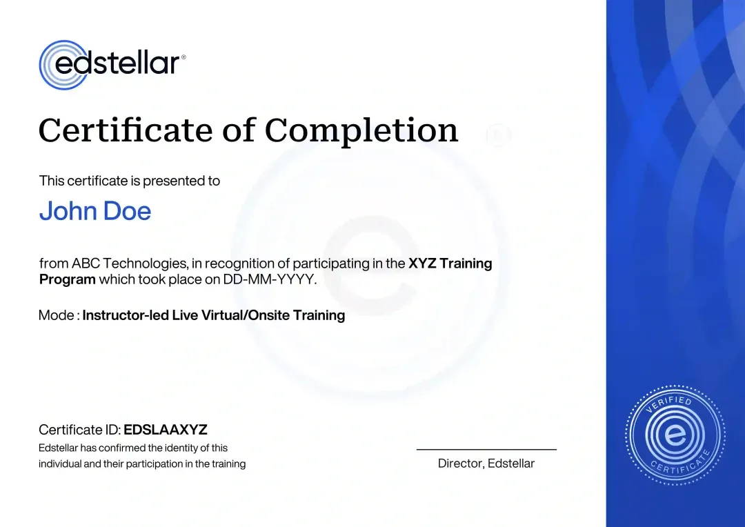
Certificate of Training Completion.
On successful completion, employees receive an Edstellar course completion certificate, recognizing their commitment to ongoing learning and professional development. It validates the skills they have built and motivates them to keep growing and contribute to organizational success.
Earned, not attended. Awarded on completion of all hands-on labs and the capstone project.
Training Delivery Modes: Virtual, Onsite and Hybrid
Choose the format that fits your agency: live virtual sessions, onsite delivery, or a hybrid mix, all with the same guided labs.
Hybrid Training
Instructor-led sessions mix onsite and virtual delivery with guided labs throughout. Teams practice parcel records, GIS checks, and planning while the instructor coaches. Hybrid keeps scheduling flexible.
- Live instruction across onsite and virtual sessions
- Guided labs with instructor coaching and reviews
- Real land records workflows in every exercise
- Flexible scheduling without losing live interaction

Onsite Training
Instructor-led training at your offices, with labs and materials set up for your teams. The instructor works through exercises in person and tunes examples to your jurisdiction and record systems.
- Instructor-led training at your offices
- Labs and materials set up for your teams
- In-person exercises and plan reviews
- Examples tuned to your jurisdiction and systems

Live Virtual Training
Live virtual sessions led by an instructor, with the same guided labs and coaching as onsite. Breakout groups collaborate on exercises, and recordings support review after each session.
- Live instructor-led virtual sessions
- Guided labs with breakout collaboration
- Same exercises and coaching as onsite
- Session recordings for later review

Need a training format that works for your team?
Full days, half days across weeks, or split by module. Tell us the delivery window and we schedule the cohort around it.
Frequently Asked Questions
Share your team size, timelines, and delivery preference, and we will send a detailed per-group quote with batch options.
Yes. A short discovery call maps your record systems, data maturity, and goals so the program is tailored before we schedule.
Yes. Instructor-led virtual sessions run in your time zone with the same guided labs and live coaching as onsite.
Yes. We deliver onsite across your locations, with labs and materials set up for your teams and your network.
The program runs 24 hours of instructor-led training, typically over three to four days or split into flexible batches.
Question not answered here?
Put it in the request. A training specialist answers it directly, within one business day.
Where this Training Fits in Your Team's learning path.
Land administration builds on a working understanding of GIS in government. This course covers land records, cadastre and governance of spatial data, then the path moves to drone surveys that keep records current and ends with sharing government data openly and responsibly.




Why Choose Edstellar as Your Land Records and Cadastre Corporate Training Provider
When comparing providers, Edstellar is the training partner teams choose for land records expertise and 5+ years of corporate training experience. Our methodology blends concise instruction with guided labs so modern records practice becomes daily work.

EXPERT TRAINERS
YEARS DELIVERING
ORGANIZATIONS TRAINED
CERTIFIED
Tailored
Every cohort's labs, record samples, and jurisdiction examples are tuned to your land systems, districts, and policy context.
Proven Methodology
A structured path from cadastre foundations to a working modernization plan, refined across public-sector training programs.
Practice-Based Learning
Guided labs with sample parcel data sets turn land records concepts into practiced skills your team keeps.
Expert Trainers
Sessions are led by practitioners who have delivered land records and cadastre programs with government agencies.
Global Scale
One consistent program rolls out across districts, departments, and field offices with local scheduling.
Measurable Outcomes
Skill checks and a reviewed capstone modernization plan show exactly what your team can do after the program.
Connect Land Registers and Parcel Maps Through Data Quality Practice
Edstellar develops land-records capability through title interpretation, cadastre operations, and geospatial checks. Participants examine record extracts, process sample parcel changes, and reconcile geometry with attributes before planning digitization and sharing. The modernization plan brings these activities together, with feedback on consistency, traceability, access controls, and the treatment of unresolved record discrepancies.
- Step 01
Consult
We explore land-administration responsibilities, record-system familiarity, and problems reconciling parcel maps, title extracts, or mutations to identify the cohort's modernization and data-quality learning needs.
- Step 02
Plan
We establish tenure and record foundations before parcel operations and GIS checks, then connect digitization, re-survey workflows, and sharing governance in the modernization plan.
- Step 03
Align
We align land-records and geospatial expertise with revenue, survey, registration, and policy teams, confirming suitable sample records and accessible GIS support for participants new to spatial tools.
- Step 04
Customize
We adapt sample titles, legacy maps, and parcel datasets to familiar jurisdictional workflows, introducing geometry and register discrepancies that require documented reconciliation decisions.
- Step 05
Execute
Participants number parcels, process mock mutations, check GIS geometry, and digitize maps, receiving feedback on attribute consistency, record traceability, and the handling of unresolved differences.
- Step 06
Evaluate
We assess the modernization plan for coherent parcel and register workflows, meaningful data-quality checks, controlled sharing, and a practical sequence for digitization and reconciliation work.
Also from Edstellar
Talent assessments
Psychometric, behavioral, leadership and 360-degree assessment.
→Training needs analysis
Needs analysis, gap identification, and a training roadmap.
→L&D consulting
Learning strategy, content, technology and ROI measurement.
→OD consulting
Org design, succession planning and cultural change.
→Managed training services
Training outsourcing, vendor management, logistics and administration.
→Coaching solutions
Executive and manager coaching that keeps skills in use.
Start an RFP shaped to your needs.
Answer three quick questions about team size, scope, and how often you need the program run, then send the request from the last step. Everything you choose travels with it, so you only fill this in once.
How many team members need training?
Land Records, Cadastre & Geospatial Governance Training Packages & Pricing
Where L&D holds an annual budget, license packages price the whole year at once instead of raising a purchase order per workshop. Hours and licenses are pooled across teams, programs and locations, so unused capacity is not stranded in one department.
Starter
120
trainee licenses64 hours of group training
Tailored for SMBs
Growth
320
trainee licenses160 hours of group training
Ideal for growing SMBs
Enterprise
800
trainee licenses400 hours of group training
Designed for large corporations
Custom
Unlimited
trainee licensesDuration set by the rollout
Multi-region and multi-year
Training Packages & Pricing
Choose the training format that works for your team. Pricing is customized based on your requirements, cohort size, and delivery needs.
Request Land Records, Cadastre and Geospatial Governance Training for Your Team
Share your team size, record systems, modernization goals, and timelines to receive a tailored training plan and quote. Book a discovery call to discuss your goals; we confirm availability and respond with a proposal.