

Cartography and Map Design Corporate Training
Turn geospatial data into clear, compelling maps your teams and stakeholders actually read.
Give your employees the mapmaking skills that turn raw geospatial data into decisions. Edstellar's Cartography & Map Design corporate training program builds professional cartographic skills across your GIS and data teams through instructor-led sessions with hands-on design labs in QGIS, ArcGIS Pro, and Mapbox Studio. As the corporate training company enterprises trust for emerging-technology programs, we tailor every workshop to your data, tools, and use cases.
Instructor-led group trainingVirtual / on-site / off-site10 languagesDelivered inEnglish, Spanish, Mandarin, German, Arabic, Portuguese, Hindi, French, Japanese, Italian100+ countriesWe have delivered inUnited States, United Kingdom, India, Canada, Germany, France, Netherlands, UAE, Saudi Arabia, Singapore, Australia, Japan, Brazil, South Africa and 90+ more countries
How we build map-fluent teams
THE EDSTELLAR CARTOGRAPHY CAPABILITY MODEL
Baseline design skills
Skills Matrix assessment reveals where your team's mapmaking breaks down today.
Set one design standard
One shared language for projections, symbology, color, and layout across every team.
Design for real
Hands-on labs in QGIS, ArcGIS Pro, and Mapbox Studio on your own data and use cases.
Prove the lift
Before-and-after design reviews measure each participant's cartographic capability.
Scale the standard
One cartographic standard rolls out across teams, cohorts, and regions.




Need more than one program?Get a group quote
Trusted as a Leading Corporate Training Provider by
















Program Overview: What is Cartography and Map Design Corporate Training?
Cartography & Map Design is Edstellar's instructor-led program for analysts, communicators, and GIS-adjacent teams who need maps that inform rather than confuse. Participants learn cartographic foundations: projections, data preparation, visual hierarchy, and thematic mapping. Across 16 hours, the program moves from static design principles to web maps and interactive cartography.
Every concept is practiced on real datasets. Participants clean and prepare spatial data, design thematic maps with honest symbology, and build interactive web maps in guided studio sessions. Instructors critique actual work, coaching on the design decisions that separate a clear map from a misleading one. The program culminates in a map storytelling capstone: a finished narrative map built to persuade.
Bad maps mislead faster than bad charts: cherry-picked breaks, distorted projections, and color ramps that lie. This program builds cartographic integrity alongside craft. Your teams learn to make maps a skeptical reader would trust.
The storytelling capstone asks each participant to take a raw dataset and deliver a finished narrative map, designed, annotated, and defended in review. Your team returns producing maps that clarify instead of decorate.
Poor map design is costly: misread colors and misleading projections lead to bad decisions and lost stakeholder trust. Participants learn the principles that make maps clear, then apply them in guided labs on datasets drawn from their own work. The program is customized to your tools and industry, so nothing stays theoretical.
The result: employees who upskill into confident mapmakers, capable of producing publication-quality static maps and interactive web maps that stakeholders read correctly the first time.
What's Included in this Workshop for Your Enterprise Teams
- 1
Cartographic principles
Projections, scale, and symbolization taught through map critiques.
- 2
Data preparation labs
Clean, join, and classify geospatial data in QGIS and ArcGIS Pro.
- 3
Visual design practice
Rebuild real maps with professional color, type, and layout.
- 4
Web map styling
Style and publish interactive maps in Mapbox Studio.
- 5
Capstone map story
Design and present a map story from your own data.
- Training delivered at any of your offices globally
- 10+ languages
- Schedule around your calendar
- Group size set along with you
- Run as one cohort or split into batches
- Instructor-led (virtual/onsite/hybrid)
- Recurring and annual options
- Trainer sourcing, matching and logistics
Build your team's skills. Anywhere in the world.
Real-world use cases
from day one
Instructor-led training
for your teams
Delivered globally
in 100+ countries


Enterprise Training Solutions Customized for Your Company
One partner for instructor-led corporate training, delivered the way your teams work.
Request a Training Quote- Customized Training Delivery
- Scale Your Training: Small to Large Teams
- In-person Onsite, Live Virtual or Hybrid Training Modes
- Plan from 2000+ Industry-ready Training Programs
- Hands-On Labs on Live Infrastructure, Led by Industry Experts
Cartography and Map Design Course Topics and Program Outline
Six modules follow a clear learning path from cartographic foundations to a capstone map story. Every workshop is customized to your data, tools, and industry, with hands-on labs that turn design principles into maps your teams can publish.
Built by Edstellar with professional cartographers and GIS practitioners
Built by map design practitioners with 5+ years of experience in geospatial visualization and corporate training.
Baseline each participant's cartography readiness before module 01 begins
Build strong map design foundations in instructor-led sessions for your team
Reinforce skills through guided hands-on labs on geodata styling and map layouts
Apply cartography skills to real-world scenarios and a capstone map design project
A short pre-training assessment sets each participant's entry level, so the program starts where your team actually is. The rest is weighted toward hands-on practice: guided labs on styling, projection, and layout plus realistic scenarios drawn from your team's work, not slides.
Delivered as
Entry level set by the assessment. Depth and schedule customized to your team.

Assess your baseline mapmaking: audit sample maps for projection, scale, and symbolization issues.
learna)Map projections and coordinate systems
b)Scale, generalization, and resolution
c)Symbolization and visual variables
d)Map elements and layout anatomy
e)Critiquing maps: spotting design flaws
Clean and join a real enterprise dataset in QGIS, reproject it, and prepare it for mapping.
practicea)Sourcing geospatial data: open and enterprise feeds
b)Cleaning and joining tabular and spatial data
c)Reprojecting and aligning coordinate systems
d)Data classification: quantiles, Jenks, and equal intervals
e)Working with vector tiles and basemap layers
Rebuild a cluttered choropleth using ColorBrewer palettes, label rules, and a clean visual hierarchy.
learna)Color theory for maps: palettes and perception
b)Typography and labeling on maps
c)Building visual hierarchy and focal points
d)Legends, scales, and north arrows that work
e)Accessibility: colorblind-safe and print-safe design
Build five thematic maps from one dataset, choosing the right technique for each message.
practicea)Choropleth maps done right
b)Proportional symbols, dot density, and isolines
c)Bivariate and multivariate mapping
d)Matching the map type to the message
e)Static maps for reports and dashboards
Style a vector-tile basemap in Mapbox Studio and publish an interactive map for stakeholder review.
practicea)Web map design: tiles, zoom levels, and performance
b)Styling maps in Mapbox Studio
c)Interactivity: tooltips, filters, and storytelling layers
d)Publishing and embedding maps for stakeholders
Design and present a map story from your own data, then defend your design choices in a structured review.
applya)Designing maps that tell a story
b)Building your capstone map portfolio
c)Capstone presentation and design review
d)Applying standards back on the job
Customize this program tailored to your team?
Tell us your training needs: what your team already works with, the level they’re at, and the topics you want them to focus on. We’ll adjust the modules, duration and hands-on labs, and send you a customized outline for your group.
Key Skills and Outcomes Your Team Will Gain
Your GIS and data teams will leave able to design publication-quality maps, from static report graphics to interactive web maps. Every outcome is practiced in hands-on labs and shown in the capstone map story.
Choose the right projection
Select map projections and coordinate systems that keep your data accurate and honest.
Design clear visual hierarchy
Use color, typography, and layout so readers see the message in seconds, not minutes.
Build accurate thematic maps
Create choropleth, dot density, and proportional symbol maps matched to the data.
Clean and prepare geospatial data
Join, reproject, and classify spatial data so it is ready for professional mapping.
Style interactive web maps
Publish vector-tile maps in Mapbox Studio with tooltips, filters, and stakeholder-ready design.
Design accessible, print-safe maps
Apply colorblind-safe palettes and print conventions for reports and presentations.
Tell stories with maps
Turn analysis into map stories that persuade executives and guide decisions.
Teams that Benefit from this Cartography and Map Design Group Training
This program is built for GIS professionals, data analysts, and product teams who turn geospatial data into maps and visualizations. Content adapts to each cohort's tools and data, so every group practices the mapmaking work their roles actually demand.
Raise every map your team ships.
GIS analysts and cartographers master projection, symbology, and thematic design, so every map your team publishes meets one professional standard.
Workflow friction
- Maps look different from analyst to analyst
- Color and symbol choices confuse readers
- Design reviews take too long
How the program helps
- One cartographic standard across the team
- Faster design reviews and approvals
- Publication-ready maps every time
Practice use cases
- Design standards
- Map reviews
- Portfolio building
Make your geospatial analysis visible.
Data analysts and BI teams learn to design clear choropleths, dashboards, and story maps that turn spatial analysis into decisions.
Workflow friction
- Great analysis hidden in unclear maps
- Executives misread choropleth colors
- Dashboards ignore map design basics
How the program helps
- Analysis presented with clarity
- Maps executives read correctly
- Dashboards that earn trust
Practice use cases
- Report maps
- Dashboards
- Story maps
Ship maps users love.
Product designers and engineers learn web map styling, tile performance, and interactive design so the maps inside your products feel crafted.
Workflow friction
- In-app maps look generic
- Slow tiles hurt the user experience
- Interactive maps lack clear design
How the program helps
- Custom-styled, on-brand maps
- Faster, better-performing web maps
- Interactive layers users understand
Practice use cases
- Mapbox styling
- Product maps
- User experience
Each cohort works through role-relevant design labs on your own data, then leaves with a capstone map story and a design standard for day-to-day work.
Prerequisites: No prior design training is needed, and GIS beginners are welcome alongside experienced analysts. What helps most is regular work with geospatial data or maps in your role. We adapt examples, datasets, and tooling to your team's experience, so a short pre-training survey helps us tune each cohort before the first session.
GIS Analyst to Map Design Standard Owner
The program takes mapmakers from cartographic foundations to confident practice: foundation principles and data preparation, intermediate visual and thematic design, then advanced web cartography and a capstone map story.
Mapmakers grow from design basics to publication-quality storytelling as the modules progress.
Mixed cohort, or several teams at once?
We can tailor the training to different teams, roles, and experience levels within the same program.
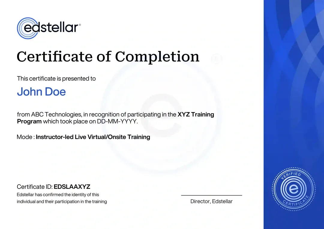
Certificate of Training Completion.
On successful completion, employees receive an Edstellar course completion certificate, recognizing their commitment to ongoing learning and professional development. It validates the skills they have built and motivates them to keep growing and contribute to organizational success.
Earned, not attended. Awarded on completion of all hands-on labs and the capstone project.
Training Delivery Modes: Virtual, Onsite and Hybrid
Every mode is shaped around your data and tools before delivery. The curriculum, hands-on labs, and capstone stay the same in each format, so what your teams can do after training never depends on how you run it.
Hybrid Training
Live instruction across office and remote sessions, with hands-on map labs coached throughout. Your teams critique, rebuild, and publish maps in QGIS, ArcGIS Pro, and Mapbox Studio with instructor guidance. Best for multi-site teams.
- Live instruction across office and remote sessions
- Design labs with instructor coaching
- Real-world datasets and your team's own use cases
- Best for teams across sites and time zones

Onsite Training
Your instructor delivers at your facility, with design labs set up for your team's data and tools. Participants build maps, style web layers, and run design reviews with direct coaching. Best for co-located teams.
- Instructor delivers at your facility
- Labs set up for your team, data, and industry
- Direct coaching during map design work
- Best for co-located teams wanting maximum interaction

Live Virtual Training
Live virtual sessions on Zoom or Microsoft Teams, with remote design labs and screen-shared guidance through every task. Your teams critique maps and build web layers together in real time. Best for distributed teams.
- Live sessions on Zoom or Microsoft Teams
- Remote access to the map design environment
- Screen-shared guidance through every lab
- Best for distributed teams

Need a training format that works for your team?
Full days, half days across weeks, or split by module. Tell us the delivery window and we schedule the cohort around it.
Frequently Asked Questions
Share your team size, preferred dates, and delivery mode in the lead form. We reply with a tailored proposal covering scope, schedule, and pricing for your group.
Both. Choose live virtual sessions on Zoom or Teams, onsite delivery at your office, or a hybrid mix across sites and time zones.
The standard program runs 16 hours of instructor-led sessions, typically over two days. We can reshape the schedule around your calendar.
We recommend 12 to 20 participants per cohort for strong design critiques. Larger teams can run as parallel batches.
Yes. We shape datasets, lab tooling, and the capstone around your industry, GIS stack, and map use cases before delivery.
Question not answered here?
Put it in the request. A training specialist answers it directly, within one business day.
Where this Training Fits in Your Team's learning path.
Cartography and map design sit second, after location intelligence basics. Your team needs to understand spatial data before designing maps from it. The path then moves to open-source GIS with QGIS and Python, and finally to spatial analysis with satellite imagery.



Why Choose Edstellar as Your Cartography and Map Design Enterprise Training Provider
From a single team workshop to an enterprise-wide rollout, Edstellar is your one-stop partner for corporate training. Tell us your goals. Our learning consultants will design a cartography program that closes skill gaps, engages your employees and delivers results you can measure.
EXPERT TRAINERS
YEARS DELIVERING
ORGANIZATIONS TRAINED
CERTIFIED
Tailored
Content shaped around your cartography and map design use cases, so every session maps to your real geospatial needs.
Proven Methodology
5+ years delivering corporate training to GIS and geospatial teams across industries and regions.
Practice-Based Learning
6 hands-on labs across 6 modules. Your team builds styled thematic and web maps with instructor guidance.
Expert Trainers
5,000+ certified trainers matched to your cartography stack, with a full trainer profile shared before your program is booked.
Global Scale
One cartography program across your offices worldwide, in hybrid, onsite, or live virtual.
Measurable Outcomes
Baseline-to-capstone measurement and Skills Matrix reporting keep your cartography capability lift visible.
Design Accurate and Readable Maps with Purposeful Visual Storytelling
Our cartography training connects data preparation and projection choices with the visual decisions that shape a map’s meaning. Participants clean spatial data, compare thematic techniques, and style an interactive map before presenting a map story. Reviews emphasize accuracy, accessibility, and appropriate interpretation so visual appeal does not obscure the evidence or distort the message.
- Step 01
Consult
We review your mapping responsibilities and data experience, identifying learning needs in projections, data preparation, thematic methods, visual hierarchy, and interactive presentation.
- Step 02
Plan
We establish cartographic principles before QGIS preparation, visual redesign, thematic comparisons, and web-map styling, culminating in a complete map story and design defense.
- Step 03
Align
We adapt GIS and design guidance for beginners and experienced analysts, confirming the QGIS and Mapbox tooling available for the selected exercises.
- Step 04
Customize
We tailor spatial datasets and stakeholder questions to relevant mapping work, making scale, projection, classification, and accessibility requirements explicit before design begins.
- Step 05
Execute
Participants reproject data, improve a choropleth, compare thematic treatments, and style a web map with feedback on accuracy, hierarchy, labels, and interpretation.
- Step 06
Evaluate
We assess the map story for appropriate projection and thematic choices, sound data preparation, readable and accessible design, and a message supported by the mapped evidence.
Also from Edstellar
Talent assessments
Psychometric, behavioral, leadership and 360-degree assessment.
→Training needs analysis
Needs analysis, gap identification, and a training roadmap.
→L&D consulting
Learning strategy, content, technology and ROI measurement.
→OD consulting
Org design, succession planning and cultural change.
→Managed training services
Training outsourcing, vendor management, logistics and administration.
→Coaching solutions
Executive and manager coaching that keeps skills in use.
Start an RFP shaped to your needs.
Answer three quick questions about team size, scope, and how often you need the program run, then send the request from the last step. Everything you choose travels with it, so you only fill this in once.
How many team members need training?
Cartography & Map Design Training Packages & Pricing
Where L&D holds an annual budget, license packages price the whole year at once instead of raising a purchase order per workshop. Hours and licenses are pooled across teams, programs and locations, so unused capacity is not stranded in one department.
Starter
120
trainee licenses64 hours of group training
Tailored for SMBs
Growth
320
trainee licenses160 hours of group training
Ideal for growing SMBs
Enterprise
800
trainee licenses400 hours of group training
Designed for large corporations
Custom
Unlimited
trainee licensesDuration set by the rollout
Multi-region and multi-year
Training Packages & Pricing
Choose the training format that works for your team. Pricing is customized based on your requirements, cohort size, and delivery needs.
Request Cartography and Map Design Training for Your Team
Share your team size, mapmaking goals, preferred delivery mode, and timelines. We will respond with a tailored training plan covering scope, schedule, and pricing, and confirm trainer availability.