

Geospatial Intelligence for Public Administration Corporate Training
Instructor-led training that helps public administration teams read, analyze, and act on spatial data with confidence.
This program shows your employees how geospatial intelligence supports better public administration. Your team will learn to source public spatial datasets, run practical spatial analysis, and build clear maps that guide policy, planning, and citizen services. Edstellar delivers every module through live instruction and guided labs, so teams leave with working maps, dashboards, and repeatable workflows they can use from day one.
Instructor-led group trainingVirtual / on-site / off-site10 languagesDelivered inEnglish, Spanish, Mandarin, German, Arabic, Portuguese, Hindi, French, Japanese, Italian100+ countriesWe have delivered inUnited States, United Kingdom, India, Canada, Germany, France, Netherlands, UAE, Saudi Arabia, Singapore, Australia, Japan, Brazil, South Africa and 90+ more countries
How we build a map-driven public service team
The Edstellar GEOSPATIAL Capability Model
Map GIS capability
Skill checks baseline your team's mapping, data handling, and spatial analysis readiness.
Standardize map workflows
Align on common spatial data formats, GIS tools, and quality checks across teams.
Practice with guided labs
Apply spatial analysis to real public-sector datasets with instructor coaching.
Measure spatial skills
Track gains in GIS proficiency, analysis accuracy, and map quality over time.
Scale across departments
Extend proven geospatial workflows to more agencies with shared playbooks.





Need more than one program?Get a group quote
Trusted as a Leading Corporate Training Provider by
















Program Overview: What is Geospatial Intelligence for Public Administration?
Geospatial Intelligence for Public Administration is a hands-on program for government teams using maps and location data to plan better and serve citizens better. Participants learn how spatial data is created, shared, and analysed, and how it connects to everyday decisions in policy, planning, and program delivery. It is built for public servants, not GIS specialists.
Training runs across six modules over 24 hours with guided labs throughout. Participants work with public sector spatial data, run spatial analysis for policy questions, build GIS mapping workflows, and apply geospatial data to governance decisions. Instructors with public sector experience review every analysis and coach the interpretation for policy use. The program closes with the Capstone: Geospatial Intelligence Project.
Governments hold vast location data while planning decisions are made on anecdote. Service gaps go unseen, resources misallocate, and policies miss the places that need them most. This program gives public teams the geospatial skills to see their jurisdiction clearly, so plans and programs are grounded in where things actually are.
The capstone is a geospatial intelligence project on a real policy or planning question: the team sources public sector spatial data, runs the analysis, builds the maps, and presents findings with recommendations. Reviewers challenge the evidence and the policy link, and the team leaves with an intelligence product its department can use.
The program blends concept sessions with guided labs. Your team will work with real public datasets covering administrative boundaries, infrastructure, and citizen services, practicing overlay, buffering, and hotspot mapping. They will also produce clear thematic maps and web dashboards for reports and public communication. By the end, each participant completes a capstone project applying geospatial intelligence to a real administration challenge, with instructor feedback on every submission. The curriculum is designed for working professionals in government and public sector organizations. No prior GIS experience is required. Each module moves from concepts to practice, so teams build working skills in spatial analysis, map design, and data storytelling they can apply to their day-to-day work. Training is delivered in a hybrid format with live instructors, flexible scheduling, and content adapted to your agency's datasets, tools, and priorities.
What's Included in this Workshop for Your Enterprise Teams
- 1
Spatial data essentials
Coordinates, projections, public data sources.
- 2
Hands-on spatial analysis labs
Overlay, buffer, and hotspot analysis on real datasets.
- 3
Map design and web publishing
Thematic maps, dashboards, interactive web maps.
- 4
Governance use cases
Service coverage, asset tracking, and location planning.
- 5
Capstone project review
Real administration problem, instructor feedback.
- Instructor-led delivery across virtual, onsite, and hybrid
- Guided labs in every module with instructor coaching
- Capstone project reviewed with your team
- Flexible scheduling around your calendar
- Lab guides, datasets, and map templates included
- Group size and batches set along with you
Build your team's skills. Anywhere in the world.
Real-world use cases
from day one
Instructor-led training
for your teams
Delivered globally
in 100+ countries


Enterprise Training Solutions Customized for Your Company
One partner for instructor-led corporate training, delivered the way your teams work.
Request a Training Quote- Customized Training Delivery
- Scale Your Training: Small to Large Teams
- In-person Onsite, Live Virtual or Hybrid Training Modes
- Plan from 2000+ Industry-ready Training Programs
- Hands-On Labs on Live Infrastructure, Led by Industry Experts
Geospatial Intelligence for Public Administration Course Topics and Program Outline
A 24-hour instructor-led program with 6 modules, 4 guided practice sessions, and a capstone project. The curriculum moves from geospatial foundations and public data through spatial analysis and mapping workflows to governance applications.
Built by Edstellar with GIS and public data practitioners
Built by practitioners who build maps and spatial analytics for government programs, shaped around your stack and use cases.
Skill checks baseline your team's map reading, data handling, and GIS tool familiarity before the program begins.
Live sessions cover geospatial foundations, public sector spatial data, and map concepts your team will use daily.
Guided labs build real skills: spatial analysis, GIS mapping workflows, and service coverage dashboards with coaching.
A capstone project applies every technique to a real public administration problem, reviewed by your instructor.
From map reading basics to a capstone geospatial project, every technique is practiced in guided labs.
Delivered as
Delivered as a hybrid program of live instruction and guided labs, scheduled around your team's calendar in flexible batches.

Explore public mapping portals and practice reading thematic government maps in a guided walkthrough.
learna)What geospatial intelligence means for public administration
b)Core concepts: coordinates, projections, scale, and layers
c)How maps support policy, planning, and citizen services
d)Reading and interpreting thematic government maps
Source open government datasets, check their quality, and prepare them for analysis in a guided lab.
learna)Finding public data: census, boundaries, and infrastructure
b)Vector and raster data: formats, attributes, and metadata
c)Judging data quality, accuracy, and update cycles
d)Cleaning and preparing datasets for analysis
Run overlay, buffer, and hotspot analysis on a sample district dataset to find service gaps.
practicea)Overlay, buffer, and proximity analysis for planning
b)Joining and aggregating data across boundaries
c)Hotspot and density analysis for service coverage
d)Guided lab: find service gaps in a district dataset
Build layered maps and publish an interactive web map for a public scheme dashboard.
practicea)Building layered maps with GIS tools
b)Styling, labeling, and thematic visualization
c)Designing maps for reports and public communication
d)Guided lab: publish a web map dashboard
Build a ward-level service coverage dashboard combining analysis, maps, and privacy-safe data handling.
practicea)Monitoring program coverage and asset inventories
b)Location planning for public facilities and services
c)Privacy and security for citizen location data
d)Guided lab: build a service coverage dashboard
Define a real administration problem, integrate spatial datasets, and present decision-ready maps for instructor review.
applya)Define a real public administration problem to solve
b)Source, clean, and integrate spatial datasets
c)Analyze data and produce decision-ready maps
d)Present findings and receive instructor review
Customize this program tailored to your team?
Tell us your training needs: what your team already works with, the level they’re at, and the topics you want them to focus on. We’ll adjust the modules, duration and hands-on labs, and send you a customized outline for your group.
Key Skills and Outcomes Your Team Will Gain
By the end of this program, your team will be able to read spatial data, run practical analysis, and build maps that support better public decisions.
Read Spatial Data
Interpret coordinates, projections, map layers, and thematic maps used in government work.
Source Government Datasets
Find, evaluate, and combine open government, census, and boundary datasets for analysis.
Run Spatial Analysis
Apply overlay, buffer, and aggregation techniques to answer real policy questions.
Build Clear Policy Maps
Design thematic maps that communicate findings to decision makers and citizens.
Publish Web Maps
Share interactive maps and dashboards for scheme monitoring and public reporting.
Protect Location Privacy
Handle citizen location data with appropriate privacy and security practices.
Deliver Map Insights
Turn spatial analysis into recommendations that decision makers can act on.
Teams that Benefit from this Geospatial Intelligence for Public Administration Group Training
This program is built for government departments and agencies that plan services, manage assets, or monitor programs across geographies. Groups from planning, policy, and field operations attend together, and the content adapts to role and experience so each cohort practices the workflows it owns.
Plan cities with spatial evidence
Help planning teams use maps and spatial analysis for zoning, infrastructure, and growth decisions.
Workflow friction
- Growth plans built without current spatial evidence
- Infrastructure data scattered across departments
- Hard to visualize impact of zoning decisions
How the program helps
- Build evidence-based land use and zoning plans
- Analyze infrastructure coverage across wards
- Create maps that explain plans to citizens
Practice use cases
- Zoning analysis
- Infrastructure mapping
- Ward-level planning
- Growth modeling
Back policy with location insight
Give policy teams the spatial analysis skills to target schemes, track outcomes, and brief leadership with maps.
Workflow friction
- Scheme targeting done without geographic evidence
- Outcome data hard to compare across districts
- Leadership briefs lack visual spatial context
How the program helps
- Target schemes using spatial evidence
- Compare program outcomes across regions
- Brief leadership with clear thematic maps
Practice use cases
- Scheme targeting
- Outcome tracking
- District comparison
- Policy briefings
Respond faster with spatial awareness
Equip emergency teams to map hazards, plan evacuation routes, and coordinate relief with real-time spatial data.
Workflow friction
- Hazard maps outdated when emergencies strike
- Relief coordination slowed by poor location data
- Evacuation planning without current road networks
How the program helps
- Map hazards and vulnerable zones quickly
- Plan evacuation routes on current networks
- Coordinate relief with shared live maps
Practice use cases
- Hazard mapping
- Evacuation planning
- Relief coordination
- Risk assessment
Support rural programs with maps
Help rural development teams map land use, plan irrigation, and monitor scheme reach across villages.
Workflow friction
- Village-level data too coarse for planning
- Irrigation and land records not mapped
- Scheme reach hard to verify on the ground
How the program helps
- Map land use and crop patterns
- Plan irrigation and watershed projects
- Verify scheme reach village by village
Practice use cases
- Land use mapping
- Watershed planning
- Scheme verification
- Village analytics
Cohorts can mix roles, since labs and examples adjust to each team's data and priorities.
Prerequisites: This program suits planning, policy, operations, and field teams in government and public sector organizations. No prior GIS experience is needed; basic comfort with spreadsheets and maps is enough to start. Content and examples adapt to each cohort's tools, datasets, and experience level.
Analyst to Geospatial Lead
The program takes teams from foundational map literacy to advanced geospatial practice, with each level building on guided labs and real public datasets.
One program that grows with public administration careers, from map basics to confident geospatial practice.
Mixed cohort, or several teams at once?
We can tailor the training to different teams, roles, and experience levels within the same program.
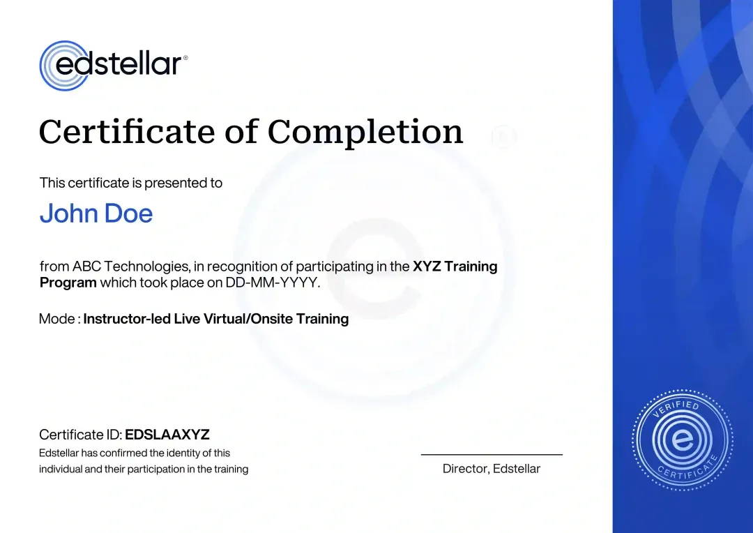
Certificate of Training Completion.
On successful completion, employees receive an Edstellar course completion certificate, recognizing their commitment to ongoing learning and professional development. It validates the skills they have built and motivates them to keep growing and contribute to organizational success.
Earned, not attended. Awarded on completion of all hands-on labs and the capstone project.
Training Delivery Modes: Virtual, Onsite and Hybrid
Choose the delivery format that fits your teams. Every format is instructor-led, with live demos and guided labs built in.
Hybrid Training
A blend of live virtual sessions and onsite workshops, led by an instructor throughout. Teams learn concepts online and practice in guided labs, with scheduling set around your calendar.
- Live virtual sessions blended with onsite workshops
- Instructor-led throughout, online and in person
- Guided labs in every format
- Scheduling set around your calendar

Onsite Training
Instructor-led sessions delivered at your office or training center, with labs run on your team's systems and datasets.
- Instructor delivers sessions at your location
- Labs run on your team's systems and datasets
- Cohort-based learning with your colleagues
- Flexible batch scheduling

Live Virtual Training
Instructor-led online sessions delivered over Zoom or Microsoft Teams, with live demos, guided labs, and Q&A built into every module.
- Live instructor-led sessions online
- Delivered over Zoom or Microsoft Teams
- Live demos, guided labs, and Q&A in every module
- Recordings and materials shared after sessions

Need a training format that works for your team?
Full days, half days across weeks, or split by module. Tell us the delivery window and we schedule the cohort around it.
Frequently Asked Questions
Share your team size, preferred dates, and location using the lead form, and we will send a tailored quote with batch options within one business day.
Yes. A short discovery call helps us understand your training needs, datasets, and goals so we can tailor the training plan before you commit.
Yes. The hybrid format includes live virtual sessions over Zoom or Microsoft Teams, combined with onsite workshops where needed.
Yes. Onsite delivery brings the instructor and guided labs to your location, using your team's systems and datasets wherever possible.
The program runs 24 hours across 6 modules, including guided labs and a capstone project. Scheduling is flexible and set around your calendar.
Question not answered here?
Put it in the request. A training specialist answers it directly, within one business day.
Where this Training Fits in Your Team's learning path.
Geospatial intelligence for public administration comes second, after location basics. Your team needs a grounding in spatial data before applying it to public services. The path then covers governing land records and cadastre, and finally building digital twins of cities and infrastructure.



Why Choose Edstellar as Your Geospatial Intelligence for Public Administration Training Provider
From the first discovery call to post-training support, we manage every detail: scheduling, batches, materials, and reporting. Your teams get a consistent, high-quality learning experience across every location and cohort.

EXPERT TRAINERS
YEARS DELIVERING
ORGANIZATIONS TRAINED
CERTIFIED
Tailored
Datasets, labs, and use cases are adapted to your agency's priorities, tools, and public data.
Proven Methodology
Live instruction combined with guided hands-on labs follows a proven practice-based methodology.
Practice-Based Learning
Every module includes mapping exercises on real public datasets, building working skills, not just theory.
Expert Trainers
Learn from GIS and public data practitioners who have delivered geospatial programs for government teams.
Global Scale
Deliver consistent training across departments, cities, and countries with centralized scheduling and reporting.
Measurable Outcomes
Assessments and capstone reviews track skill gains in spatial analysis, mapping quality, and tool proficiency.
Use Geospatial Evidence to Explain Public Service Gaps and Policy Choices
Edstellar develops public-sector geospatial capability through practical service-planning cases. Participants source and check government data, analyze spatial relationships, and create layered maps before assembling a coverage dashboard. The final project is reviewed for data quality, privacy-aware presentation, and the strength of the connection between mapped evidence and the administrative question.
- Step 01
Consult
We explore service-planning questions and difficulties interpreting location data, establishing participants' comfort with maps and spreadsheets and their policy, operations, or field responsibilities.
- Step 02
Plan
Geospatial foundations lead into public data sourcing, policy-focused spatial analysis, web mapping, and governance dashboards before the complete administration project is presented.
- Step 03
Align
We align geospatial and public-sector facilitation with planning and operational roles, confirming appropriate data sources and tools without assuming previous GIS experience.
- Step 04
Customize
Open or fictional district datasets reflect relevant public-service questions, supporting coverage analysis while avoiding unnecessary exposure of individual locations or sensitive administrative records.
- Step 05
Execute
Participants run overlays and hotspot analyses, build layered maps, and develop coverage dashboards, receiving feedback on data quality, interpretation, and privacy-aware communication.
- Step 06
Evaluate
We assess the project for a clearly framed administrative problem, validated spatial inputs, intelligible maps, and policy-relevant findings that do not overstate the evidence.
Also from Edstellar
Talent assessments
Psychometric, behavioral, leadership and 360-degree assessment.
→Training needs analysis
Needs analysis, gap identification, and a training roadmap.
→L&D consulting
Learning strategy, content, technology and ROI measurement.
→OD consulting
Org design, succession planning and cultural change.
→Managed training services
Training outsourcing, vendor management, logistics and administration.
→Coaching solutions
Executive and manager coaching that keeps skills in use.
Start an RFP shaped to your needs.
Answer three quick questions about team size, scope, and how often you need the program run, then send the request from the last step. Everything you choose travels with it, so you only fill this in once.
How many team members need training?
Geospatial Intelligence for Public Administration Training Training Packages & Pricing
Where L&D holds an annual budget, license packages price the whole year at once instead of raising a purchase order per workshop. Hours and licenses are pooled across teams, programs and locations, so unused capacity is not stranded in one department.
Starter
120
trainee licenses64 hours of group training
Tailored for SMBs
Growth
320
trainee licenses160 hours of group training
Ideal for growing SMBs
Enterprise
800
trainee licenses400 hours of group training
Designed for large corporations
Custom
Unlimited
trainee licensesDuration set by the rollout
Multi-region and multi-year
Training Packages & Pricing
Choose the training format that works for your team. Pricing is customized based on your requirements, cohort size, and delivery needs.
Request Geospatial Intelligence for Public Administration Training for Your Team
Tell us about your teams, timelines, and goals. We will schedule a discovery call, confirm availability, and design a program around your agency's datasets and priorities.